Waterway information

Kind:
Inland
Driving areas:
🇫🇮 Finland
Length:
39.9 km¹
¹River kilometers or bank length recorded in NavShip, including river arms and harbor entrances.
Availability:
Completely recorded
Recent Update: 06.11.2024²
² This date indicates when an adjustment last took place in the course of the body of water
Recorded:
Locks: 0
Harbours / marinas: 2
Bridges: 2
Berths: 0
Slipways: 1
Fuelstations: 0
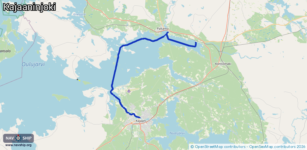
Route:
Please wait, loading route graphic...
Request waterway overview map with symbol legend here (Link).
Information about data associated with this body of water (5 available):
Data by OpenSeaMap (c) OSM contributors, www.openseamap.org
| # | Kind | Coordinates | Name | Information |
|---|---|---|---|---|
| 1 | Marina | 64.40109,27.85449 | 2025-10-04T09:59:42Z | |
| 2 | Marina | 64.39914,27.8564 | 2022-01-18T17:37:29Z | Vierasvenesatama |
| 3 | Bridge | 64.23282,27.70811 | Unknown | Clearance height: 2023-09-08T14:05:22Z m Movable bridge (e.g. lifting bridge or drawbridge) drawbridge |
| 4 | Bridge | 64.23331,27.70888 | Unknown | Clearance height: 2023-09-08T14:05:40Z m Movable bridge (e.g. lifting bridge or drawbridge) pontoon |
| 5 | Slipway | 64.38035,27.9842 | Unknown | 2021-06-03T05:30:00Z |