Waterway information

Kind:
Inland
Driving areas:
🇺🇸 United States of America
Length:
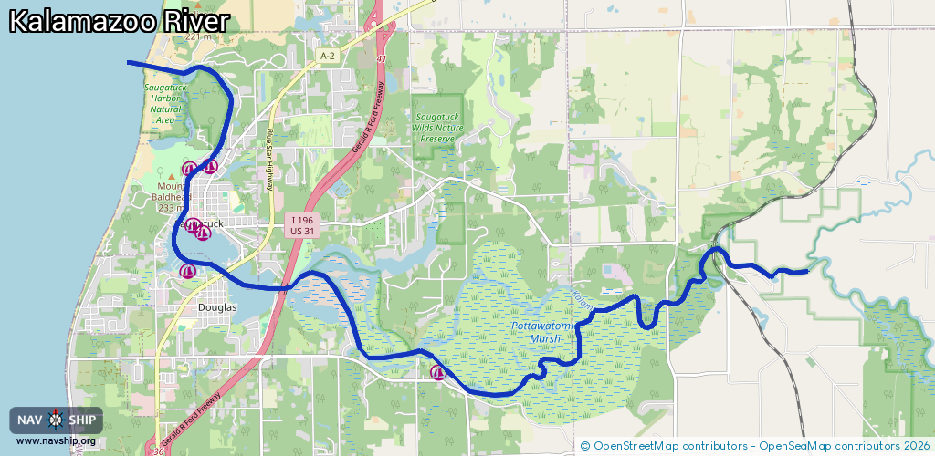
18.2 km¹
¹River kilometers or bank length recorded in NavShip, including river arms and harbor entrances.
Availability:
Completely recorded
Recent Update: 11.02.2026²
² This date indicates when an adjustment last took place in the course of the body of water
Recorded:
Locks: 0
Harbours / marinas: 6
Bridges: 0
Berths: 0
Slipways: 0
Fuelstations: 0
Route:
Please wait, loading route graphic...
Request waterway overview map with symbol legend here (Link).
Information about data associated with this body of water (6 available):
Data by OpenSeaMap (c) OSM contributors, www.openseamap.org
| # | Kind | Coordinates | Name | Information |
|---|---|---|---|---|
| 1 | Marina | 42.63443,-86.1594 | 2026-02-18T19:09:03Z | Deep Harbor Marina |
| 2 | Marina | 42.64801,-86.20726 | 2025-11-24T18:23:21Z | Safe Harbor Tower Marine |
| 3 | Marina | 42.65481,-86.20518 | 2025-11-27T12:02:53Z | Singapore Yacht Club |
| 4 | Marina | 42.65375,-86.20329 | 2026-01-22T13:55:38Z | Sergeant Marina +1 269 857 2873 https://www.sergeantmarina.com/ |
| 5 | Marina | 42.66244,-86.20577 | 2025-05-27T18:54:47Z | Shore Harbor Marina |
| 6 | Marina | 42.66276,-86.20191 | 2025-11-24T18:23:21Z | Saugatuck Yacht Service |