Waterway information

Kind:
Inland
Driving areas:
🇫🇮 Finland
Length:
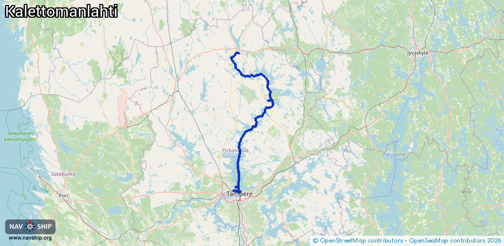
128.2 km¹
¹River kilometers or bank length recorded in NavShip, including river arms and harbor entrances.
Availability:
Completely recorded
Recent Update: 02.09.2025²
² This date indicates when an adjustment last took place in the course of the body of water
Recorded:
Locks: 1
Harbours / marinas: 6
Bridges: 1
Berths: 0
Slipways: 1
Fuelstations: 1
Route:
Please wait, loading route graphic...
Request waterway overview map with symbol legend here (Link).
Information about data associated with this body of water (9 available):
Data by OpenSeaMap (c) OSM contributors, www.openseamap.org
| # | Kind | Coordinates | Name | Information |
|---|---|---|---|---|
| 1 | Marina | 61.50774,23.71177 | 2024-08-15T10:34:25Z | Santalahden venesatama |
| 2 | Marina | 61.50922,23.76983 | 2025-01-04T14:02:44Z | Naistenlahden satama |
| 3 | Marina | 61.98919,24.07686 | 2025-06-30T12:14:47Z | Ruoveden laivaranta https://www.ruovesi.fi/laivaranta-ja-venepaikat_2 |
| 4 | Marina | 61.53065,23.71458 | 2025-08-12T13:25:59Z | Veneiden säilytysalue |
| 5 | Marina | 61.50402,23.74618 | 2025-09-04T17:04:02Z | Mustalahden satama |
| 6 | Marina | 62.23827,23.7544 | 2021-04-07T12:27:38Z | Virtain satama |
| 7 | Bridge | 61.50408,23.74584 | Unknown | Clearance height: 2025-04-02T15:51:31Z m Movable bridge (e.g. lifting bridge or drawbridge) |
| 8 | Slipway | 62.23674,23.75844 | Unknown | 2021-04-07T12:27:38Z Kalettomanlahden veneenlaskupaikka |
| 9 | Fuel station | 61.98902,24.07647 | 2024-07-23T19:56:43Z | |
| 9 | Fuel station | 61.98902,24.07647 | 2024-07-23T19:56:43Z |