Waterway information

Kind:
Inland
Driving areas:
🇵🇱 Poland
Length:
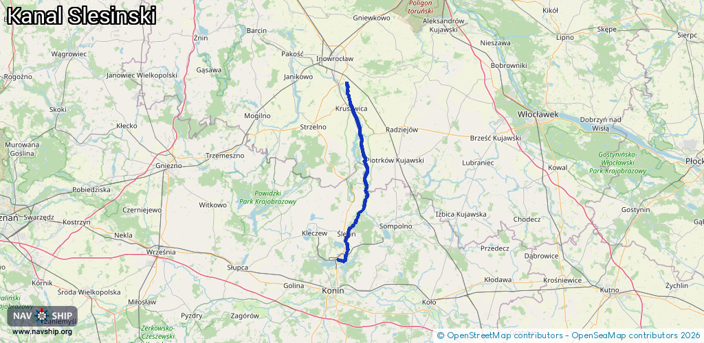
55.3 km¹
¹River kilometers or bank length recorded in NavShip, including river arms and harbor entrances.
Availability:
Completely recorded
Recent Update: 04.04.2025²
² This date indicates when an adjustment last took place in the course of the body of water
Recorded:
Locks: 2
Harbours / marinas: 4
Bridges: 0
Berths: 0
Slipways: 1
Fuelstations: 0
Route:
Please wait, loading route graphic...
Request waterway overview map with symbol legend here (Link).
Information about data associated with this body of water (7 available):
Data by OpenSeaMap (c) OSM contributors, www.openseamap.org
| # | Kind | Coordinates | Name | Information |
|---|---|---|---|---|
| 1 | Marina | 52.66954,18.32633 | 2025-03-16T07:35:09Z | Klub Żeglarski LOK „Popiel” [email protected] +48601419014 http://www.kzpopiel-kruszwica.org/ |
| 2 | Marina | 52.37152,18.31275 | 2016-11-09T22:25:03Z | Przystań Wodna w Ślesinie |
| 3 | Marina | 52.32467,18.31061 | 2020-08-01T10:27:06Z | bernardynkaport |
| 4 | Marina | 52.30756,18.26786 | 2025-03-16T06:52:28Z | Klub Żeglarski przy Kopalni Węgla Brunatnego „Konin” S.A. |
| 5 | Slipway | 52.32478,18.30634 | small_craft_facility | 2017-03-03T15:04:00Z bernardynkaport |
| 6 | Lock | 52.43485,18.37491 | Unknown | |
| 7 | Lock | 52.42361,18.36091 | Unknown |