Waterway information

Kind:
Inland
Driving areas:
🇵🇱 Poland
Length:
20.8 km¹
¹River kilometers or bank length recorded in NavShip, including river arms and harbor entrances.
Availability:
Completely recorded
Recent Update: 30.04.2025²
² This date indicates when an adjustment last took place in the course of the body of water
Recorded:
Locks: 0
Harbours / marinas: 4
Bridges: 2
Berths: 0
Slipways: 3
Fuelstations: 1
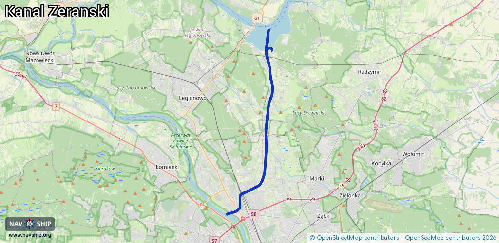
Route:
Please wait, loading route graphic...
Request waterway overview map with symbol legend here (Link).
Information about data associated with this body of water (10 available):
Data by OpenSeaMap (c) OSM contributors, www.openseamap.org
| # | Kind | Coordinates | Name | Information |
|---|---|---|---|---|
| 1 | Marina | 52.43653,21.042 | 2025-10-06T21:01:18Z | Port Nieporęt |
| 2 | Marina | 52.4382,21.04349 | 2022-04-16T19:46:19Z | Port Pilawa |
| 3 | Marina | 52.43412,21.0327 | 2025-04-24T08:37:25Z | Port jachtowy Wodnik http://tkkfwodnik.waw.pl/ |
| 4 | Marina | 52.36094,21.03365 | 2022-09-17T08:44:00Z | |
| 5 | Bridge | 52.31247,21.00039 | Unknown | Clearance height: 2017-02-11T22:02:57Z m Maximum passage width: 6.5 m fixed |
| 6 | Bridge | 52.31201,20.99885 | Unknown | Clearance height: 2017-02-11T22:02:57Z m Maximum passage width: 5.2 m fixed |
| 7 | Slipway | 52.43595,21.04122 | small_craft_facility | 2021-08-19T14:35:00Z |
| 8 | Slipway | 52.4371,21.04063 | small_craft_facility | 2021-08-26T10:38:07Z |
| 9 | Slipway | 52.43769,21.04347 | small_craft_facility | 2022-04-17T19:39:19Z |
| 10 | Fuel station | 52.43585,21.04124 | 2020-07-23T12:52:30Z | Orlen Orlen |