Waterway information

Kind:
Inland
Driving areas:
🇺🇸 United States of America
Length:
2.1 km¹
¹River kilometers or bank length recorded in NavShip, including river arms and harbor entrances.
Availability:
Completely recorded
Recent Update: 19.02.2024²
² This date indicates when an adjustment last took place in the course of the body of water
Recorded:
Locks: 0
Harbours / marinas: 2
Bridges: 0
Berths: 0
Slipways: 1
Fuelstations: 0
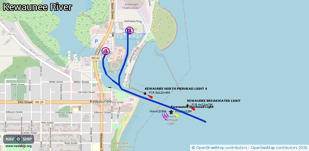
Route:
Please wait, loading route graphic...
Request waterway overview map with symbol legend here (Link).
Information about data associated with this body of water (3 available):
Data by OpenSeaMap (c) OSM contributors, www.openseamap.org
| # | Kind | Coordinates | Name | Information |
|---|---|---|---|---|
| 1 | Marina | 44.46538,-87.49859 | 2024-09-08T12:36:15Z | Yacht Works Kewaunee https://www.yachtworks.com/yacht-works-kewaunee/ |
| 2 | Marina | 44.46336,-87.50243 | 2024-09-08T10:59:25Z | Kewaunee Marina https://cityofkewauneewi.gov/departments/marina/ |
| 3 | Slipway | 44.46615,-87.49926 | small_craft_facility | 2024-09-08T12:36:15Z |