Waterway information

Kind:
Sea
Driving areas:
🌊 Baltic Sea🇩🇪 Germany
Length:
1 km¹
¹River kilometers or bank length recorded in NavShip, including river arms and harbor entrances.
Availability:
Completely recorded
Recent Update: 15.08.2023²
² This date indicates when an adjustment last took place in the course of the body of water
Recorded:
Locks: 0
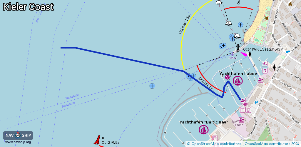
Harbours / marinas: 2
Bridges: 0
Berths: 0
Slipways: 3
Fuelstations: 0
Route:
Please wait, loading route graphic...
Request waterway overview map with symbol legend here (Link).
Information about data associated with this body of water (5 available):
Data by OpenSeaMap (c) OSM contributors, www.openseamap.org
| # | Kind | Coordinates | Name | Information |
|---|---|---|---|---|
| 1 | Marina | 54.40225,10.2162 | 2023-11-09T00:08:28Z | Yachthafen Laboe Gemeindehafen [email protected] +49 4343 427556 https://www.yachthafen-laboe.de/ |
| 2 | Marina | 54.40034,10.21459 | 2023-11-09T00:08:11Z | Yachthafen Baltic Bay [email protected] +49 4343 421151 https://www.schiffswerftlaboe.de/marina.html |
| 3 | Slipway | 54.40144,10.2167 | small_craft_facility | 2013-02-13T15:52:31Z |
| 4 | Slipway | 54.40233,10.21799 | small_craft_facility | 2014-06-09T20:24:24Z |
| 5 | Slipway | 54.40062,10.2166 | small_craft_facility | 2014-06-09T20:24:24Z |