Waterway information

Kind:
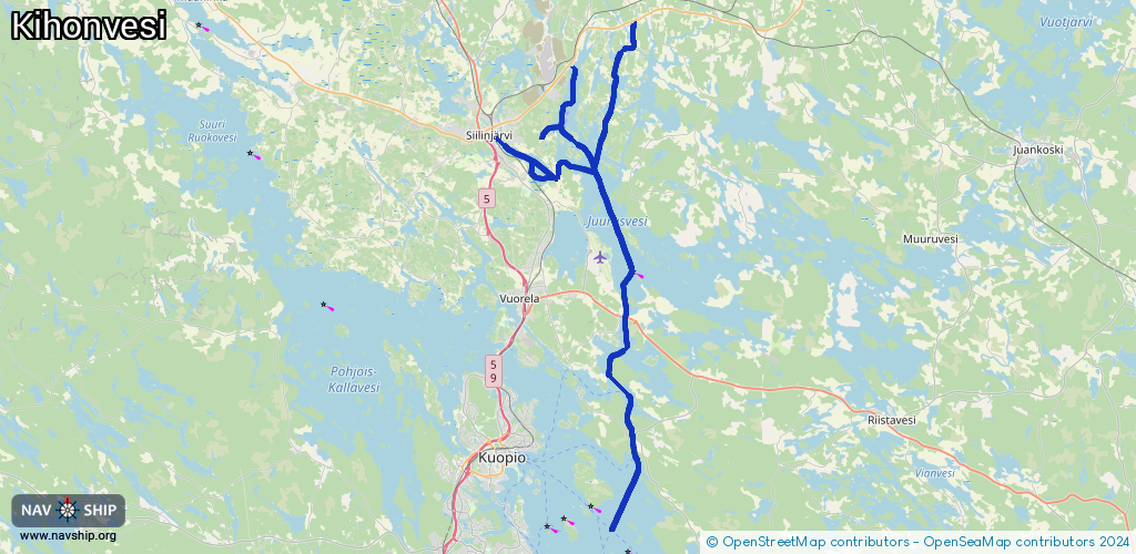
Inland
Driving areas:
🇫🇮 Finland
Length:
60.1 km¹
¹River kilometers or bank length recorded in NavShip, including river arms and harbor entrances.
Availability:
Completely recorded
Recent Update: 16.04.2025²
² This date indicates when an adjustment last took place in the course of the body of water
Recorded:
Locks: 0
Harbours / marinas: 15
Bridges: 0
Berths: 0
Slipways: 0
Fuelstations: 0
Route:
Please wait, loading route graphic...
Request waterway overview map with symbol legend here (Link).
Information about data associated with this body of water (15 available):
Data by OpenSeaMap (c) OSM contributors, www.openseamap.org
| # | Kind | Coordinates | Name | Information |
|---|---|---|---|---|
| 1 | Marina | 63.07815,27.73308 | 2023-07-21T20:07:04Z | |
| 2 | Marina | 63.05204,27.71175 | 2022-10-01T08:57:20Z | |
| 3 | Marina | 63.12378,27.83406 | 2020-11-08T13:23:24Z | |
| 4 | Marina | 63.00391,27.7278 | 2025-04-12T11:40:56Z | |
| 5 | Marina | 63.07158,27.67056 | 2022-10-01T08:54:11Z | Vierasvenesatama |
| 6 | Marina | 63.07007,27.67165 | 2022-10-01T08:55:13Z | |
| 7 | Marina | 63.06869,27.6747 | 2022-10-01T08:55:55Z | |
| 8 | Marina | 63.07134,27.67788 | 2025-07-28T13:24:02Z | |
| 9 | Marina | 63.06607,27.68025 | 2023-07-14T20:15:32Z | |
| 10 | Marina | 63.06582,27.68084 | 2023-07-14T20:15:32Z | |
| 11 | Marina | 63.06677,27.67887 | 2023-07-14T20:15:32Z | |
| 12 | Marina | 63.0663,27.67962 | 2023-07-14T20:15:32Z | |
| 13 | Marina | 63.0644,27.68135 | 2022-10-01T08:47:25Z | Kanavatien venepaikat |
| 14 | Marina | 63.06671,27.69533 | 2022-10-01T08:56:40Z | |
| 15 | Marina | 63.09122,27.75208 | 2025-07-19T21:53:09Z |