Waterway information

Kind:
Inland
Driving areas:
🇳🇱 Netherlands🌊 North Sea
Length:
2.1 km¹
¹River kilometers or bank length recorded in NavShip, including river arms and harbor entrances.
Availability:
Completely recorded
Recent Update: 30.01.2019²
² This date indicates when an adjustment last took place in the course of the body of water
Recorded:
Locks: 0
Harbours / marinas: 1
Bridges: 6
Berths: 0
Slipways: 0
Fuelstations: 0
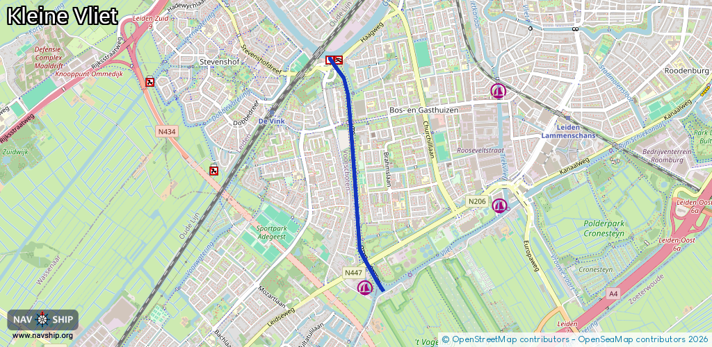
Route:
Please wait, loading route graphic...
Request waterway overview map with symbol legend here (Link).
Information about data associated with this body of water (7 available):
Data by OpenSeaMap (c) OSM contributors, www.openseamap.org
| # | Kind | Coordinates | Name | Information |
|---|---|---|---|---|
| 1 | Marina | 52.13388,4.46787 | 2024-11-29T20:07:43Z | Jachtwerf Allemansgeest https://www.jachtwerfallemansgeest.nl/ |
| 2 | Bridge | 52.15078,4.46412 | 10.4 | Clearance height: 2020-10-29T10:58:07Z m Maximum passage width: 2.5 m Movable bridge (e.g. lifting bridge or drawbridge) fixed |
| 3 | Bridge | 52.15072,4.464 | 10.5 | Clearance height: 2022-06-06T15:36:01Z m Maximum passage width: 2.2 m Movable bridge (e.g. lifting bridge or drawbridge) opening |
| 4 | Bridge | 52.14645,4.46593 | 10.5 | Clearance height: 2022-06-06T14:56:09Z m Maximum passage width: 2.6 m Movable bridge (e.g. lifting bridge or drawbridge) opening |
| 5 | Bridge | 52.14646,4.46612 | 10.4 | Clearance height: 2022-06-06T15:36:07Z m Maximum passage width: 2.9 m Movable bridge (e.g. lifting bridge or drawbridge) fixed |
| 6 | Bridge | 52.13573,4.46816 | 10.4 | Clearance height: 2022-06-06T15:36:00Z m Maximum passage width: 2.9 m Movable bridge (e.g. lifting bridge or drawbridge) fixed |
| 7 | Bridge | 52.13567,4.46797 | 10.5 | Clearance height: 2022-06-06T15:36:00Z m Maximum passage width: 2.5 m Movable bridge (e.g. lifting bridge or drawbridge) bascule |