Waterway information

Kind:
Inland
Driving areas:
🇳🇱 Netherlands
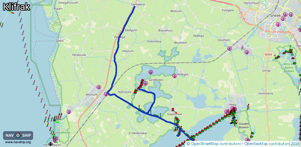
Length:
19 km¹
¹River kilometers or bank length recorded in NavShip, including river arms and harbor entrances.
Availability:
Completely recorded
Recent Update: 08.08.2023²
² This date indicates when an adjustment last took place in the course of the body of water
Recorded:
Locks: 0
Harbours / marinas: 0
Bridges: 3
Berths: 5
Slipways: 0
Fuelstations: 0
Route:
Please wait, loading route graphic...
Request waterway overview map with symbol legend here (Link).
Information about data associated with this body of water (8 available):
Data by OpenSeaMap (c) OSM contributors, www.openseamap.org
| # | Kind | Coordinates | Name | Information |
|---|---|---|---|---|
| 1 | Bridge | 52.97882,5.46535 | 7.00 | Clearance height: 2020-08-15T17:12:55Z m Maximum passage width: 1.30 m Movable bridge (e.g. lifting bridge or drawbridge) opening BB H12 W70 VHF20 |
| 2 | Bridge | 52.98374,5.46976 | 7 | Clearance height: 2013-04-04T13:53:36Z m Maximum passage width: 1.22 m Movable bridge (e.g. lifting bridge or drawbridge) opening BB H10 W68 |
| 3 | Bridge | 53.01864,5.47876 | 7.27 | Clearance height: 2013-04-04T13:53:36Z m Maximum passage width: 0.81 m Movable bridge (e.g. lifting bridge or drawbridge) opening BB H7.5 W69.5 |
| 4 | Berth | 52.94558,5.5648 | 2025-07-10T13:11:15Z | FL24A |
| 5 | Berth | 52.94536,5.56509 | 2023-11-21T00:33:05Z | FL24B |
| 6 | Berth | 52.94943,5.547 | 2025-07-09T22:05:46Z | FL23C |
| 7 | Berth | 52.94904,5.54646 | 2025-07-09T22:05:46Z | FL23B |
| 8 | Berth | 52.94867,5.54756 | 2025-07-09T22:05:46Z | FL23D |