Waterway information

Kind:
Inland
Driving areas:
🌊 Atlantic Ocean🇺🇸 United States of America
Length:
3.6 km¹
¹River kilometers or bank length recorded in NavShip, including river arms and harbor entrances.
Availability:
Completely recorded
Recent Update: 21.07.2025²
² This date indicates when an adjustment last took place in the course of the body of water
Recorded:
Locks: 0
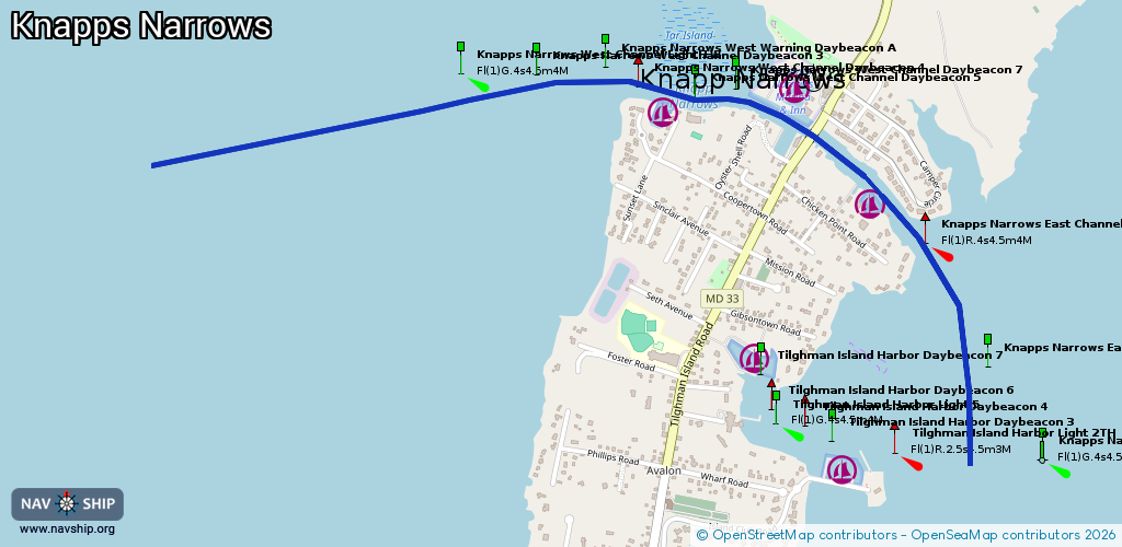
Harbours / marinas: 3
Bridges: 1
Berths: 0
Slipways: 0
Fuelstations: 0
Route:
Please wait, loading route graphic...
Request waterway overview map with symbol legend here (Link).
Information about data associated with this body of water (4 available):
Data by OpenSeaMap (c) OSM contributors, www.openseamap.org
| # | Kind | Coordinates | Name | Information |
|---|---|---|---|---|
| 1 | Marina | 38.71747,-76.33028 | 2023-01-14T01:02:18Z | |
| 2 | Marina | 38.72111,-76.33375 | 2023-01-14T01:02:18Z | Knapp's Narrows Marina & Inn customers [email protected] +1 410 886 2720 http://knappsnarrowsmarina.com |
| 3 | Marina | 38.72023,-76.33822 | 2025-01-01T19:45:35Z | Tilghman Island Marina customers +1 410 886 2500 http://tilghmanmarina.com |
| 4 | Bridge | 38.71953,-76.33249 | 12.8 | Clearance height: 2024-01-28T17:54:51Z m Maximum passage width: 3.6 m Movable bridge (e.g. lifting bridge or drawbridge) bascule |