Waterway information

Kind:
Inland
Driving areas:
🇺🇦 Ukraine
Length:
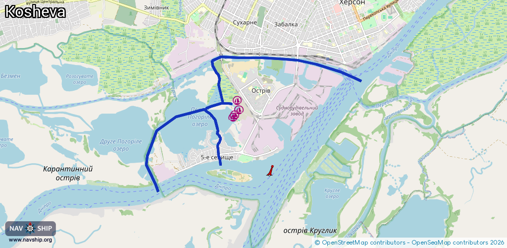
10.8 km¹
¹River kilometers or bank length recorded in NavShip, including river arms and harbor entrances.
Availability:
Completely recorded
Recent Update: 03.10.2025²
² This date indicates when an adjustment last took place in the course of the body of water
Recorded:
Locks: 0
Harbours / marinas: 4
Bridges: 0
Berths: 0
Slipways: 0
Fuelstations: 0
Route:
Please wait, loading route graphic...
Request waterway overview map with symbol legend here (Link).
Information about data associated with this body of water (4 available):
Data by OpenSeaMap (c) OSM contributors, www.openseamap.org
| # | Kind | Coordinates | Name | Information |
|---|---|---|---|---|
| 1 | Marina | 46.61654,32.57445 | 2023-10-23T02:10:55Z | Човновий причал №5 Судобудівник |
| 2 | Marina | 46.61433,32.57506 | 2023-10-23T02:10:55Z | Човновий причал №9 |
| 3 | Marina | 46.6131,32.57356 | 2023-03-11T13:58:25Z | Яхт клуб Стеблеєвський |
| 4 | Marina | 46.61286,32.57329 | 2023-05-05T19:16:02Z |