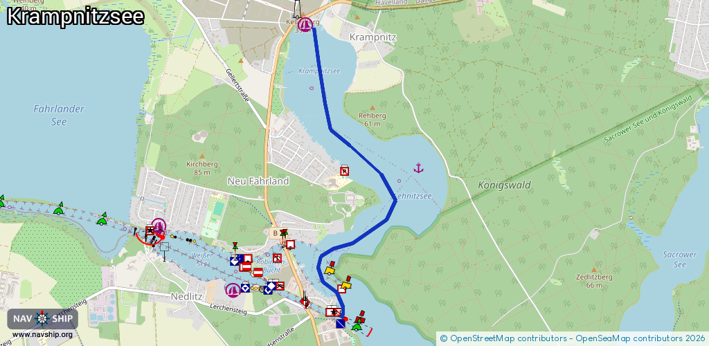
Waterway information

Kind:
Inland
Driving areas:
🇩🇪 Germany
Length:
3.1 km¹
¹River kilometers or bank length recorded in NavShip, including river arms and harbor entrances.
Availability:
Completely recorded
Recent Update: 10.04.2025²
² This date indicates when an adjustment last took place in the course of the body of water
Recorded:
Locks: 0
Harbours / marinas: 1
Bridges: 0
Berths: 1
Slipways: 1
Fuelstations: 0
Route:
Please wait, loading route graphic...
Request waterway overview map with symbol legend here (Link).
Information about data associated with this body of water (3 available):
Data by OpenSeaMap (c) OSM contributors, www.openseamap.org
| # | Kind | Coordinates | Name | Information |
|---|---|---|---|---|
| 1 | Marina | 52.45814,13.05092 | 2023-11-14T21:42:52Z | Bootscenter Krampnitzsee +49 33208 50883 https://skipper.adac.de/en/marinas/bootscenter-krampnitzsee/ |
| 2 | Slipway | 52.45828,13.05113 | small_craft_facility | 2022-01-16T07:55:03Z |
| 3 | Berth | 52.44731,13.06502 | 2020-06-28T16:29:22Z |