Waterway information

Kind:
Inland
Driving areas:
🌊 North Sea🇳🇴 Norway
Length:
6.5 km¹
¹River kilometers or bank length recorded in NavShip, including river arms and harbor entrances.
Availability:
Completely recorded
Recent Update: 24.01.2024²
² This date indicates when an adjustment last took place in the course of the body of water
Recorded:
Locks: 0
Harbours / marinas: 1
Bridges: 0
Berths: 0
Slipways: 1
Fuelstations: 2
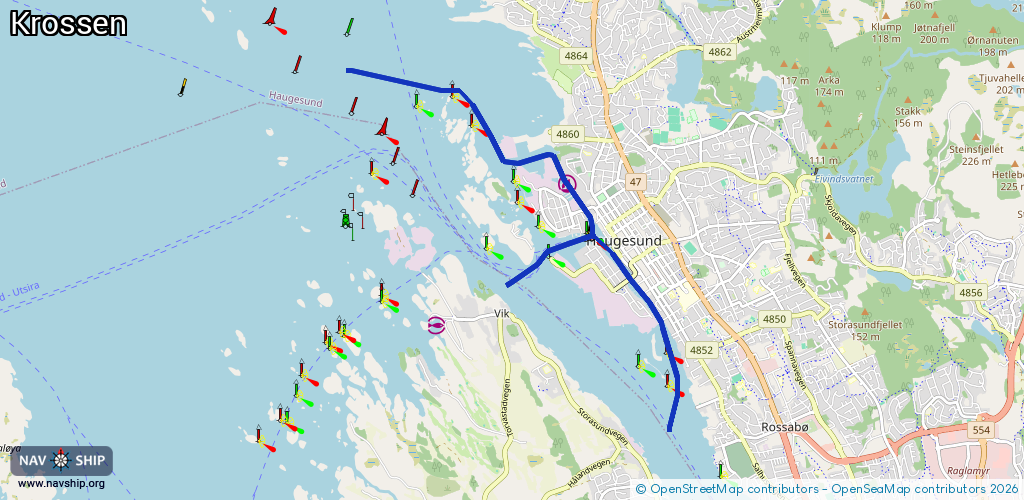
Route:
Please wait, loading route graphic...
Request waterway overview map with symbol legend here (Link).
Information about data associated with this body of water (4 available):
Data by OpenSeaMap (c) OSM contributors, www.openseamap.org
| # | Kind | Coordinates | Name | Information |
|---|---|---|---|---|
| 1 | Marina | 59.4187,5.25835 | 2016-04-16T12:32:20Z | |
| 2 | Slipway | 59.41921,5.25421 | small_craft_facility | 2020-03-13T00:44:39Z |
| 3 | Fuel station | 59.41947,5.25806 | 2024-07-20T06:57:59Z | Haugesund marineservice |
| 4 | Fuel station | 59.41413,5.25673 | 2024-07-20T06:57:59Z | Apollo marina |