Waterway information

Kind:
Inland
Driving areas:
🇩🇪 Germany
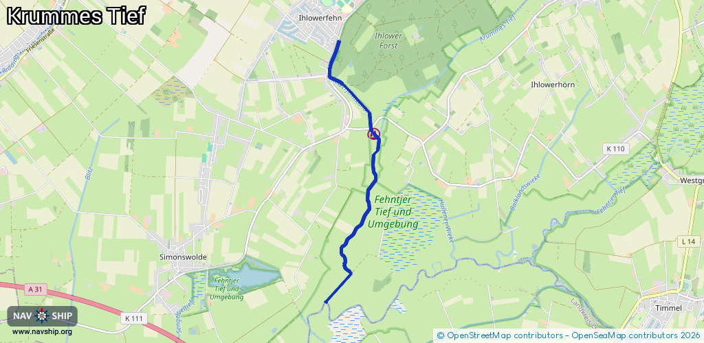
Length:
5.3 km¹
¹River kilometers or bank length recorded in NavShip, including river arms and harbor entrances.
Availability:
Completely recorded
Recent Update: 24.07.2023²
² This date indicates when an adjustment last took place in the course of the body of water
Recorded:
Locks: 0
Harbours / marinas: 1
Bridges: 3
Berths: 0
Slipways: 1
Fuelstations: 0
Route:
Please wait, loading route graphic...
Request waterway overview map with symbol legend here (Link).
Information about data associated with this body of water (5 available):
Data by OpenSeaMap (c) OSM contributors, www.openseamap.org
| # | Kind | Coordinates | Name | Information |
|---|---|---|---|---|
| 1 | Marina | 53.38964,7.4482 | 2025-11-17T09:43:40Z | BSV Ihlow +49 4929 990442 https://www.bsv-ihlow.de/ |
| 2 | Bridge | 53.40197,7.4385 | Unknown | Clearance height: 2022-06-26T09:09:35Z m opening |
| 3 | Bridge | 53.40026,7.43746 | Unknown | Clearance height: 2022-06-26T09:09:35Z m opening |
| 4 | Bridge | 53.39048,7.44724 | Unknown | Clearance height: 2014-05-03T17:16:45Z m opening |
| 5 | Slipway | 53.39011,7.44729 | small_craft_facility | 2025-01-04T12:08:39Z |