Waterway information

Kind:
Inland
Driving areas:
🇳🇴 Norway
Length:
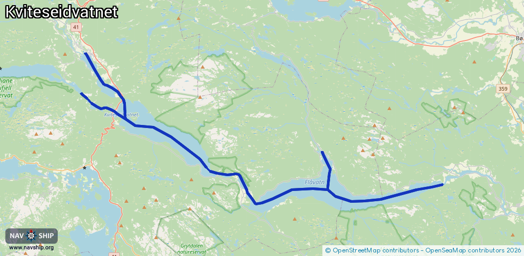
40.9 km¹
¹River kilometers or bank length recorded in NavShip, including river arms and harbor entrances.
Availability:
Completely recorded
Recent Update: 25.09.2023²
² This date indicates when an adjustment last took place in the course of the body of water
Recorded:
Locks: 0
Harbours / marinas: 3
Bridges: 4
Berths: 0
Slipways: 4
Fuelstations: 0
Route:
Please wait, loading route graphic...
Request waterway overview map with symbol legend here (Link).
Information about data associated with this body of water (11 available):
Data by OpenSeaMap (c) OSM contributors, www.openseamap.org
| # | Kind | Coordinates | Name | Information |
|---|---|---|---|---|
| 1 | Marina | 59.40123,8.48915 | 2023-05-10T08:28:56Z | Kyrkjebø brygge |
| 2 | Marina | 59.36319,8.52513 | 2023-05-10T08:28:56Z | Spjotsodd brygge |
| 3 | Marina | 59.30438,8.70104 | 2023-05-10T08:28:56Z | Fjågesund brygge |
| 4 | Bridge | 59.37404,8.53106 | Unknown | Clearance height: 2023-04-18T12:20:40Z m Maximum passage width: 4 m Movable bridge (e.g. lifting bridge or drawbridge) swing |
| 5 | Bridge | 59.37179,8.53384 | Unknown | Clearance height: 2023-04-17T12:33:15Z m Movable bridge (e.g. lifting bridge or drawbridge) fixed |
| 6 | Bridge | 59.36335,8.52251 | Unknown | Clearance height: 2023-04-17T09:16:01Z m Movable bridge (e.g. lifting bridge or drawbridge) fixed |
| 7 | Bridge | 59.30773,8.70136 | Unknown | Clearance height: 2023-04-17T09:16:01Z m Movable bridge (e.g. lifting bridge or drawbridge) fixed |
| 8 | Slipway | 59.40249,8.48675 | small_craft_facility | 2023-05-09T14:36:59Z Kviteseid |
| 9 | Slipway | 59.36499,8.51694 | small_craft_facility | 2023-05-09T14:36:59Z Spjotsodd |
| 10 | Slipway | 59.30907,8.91228 | small_craft_facility | 2023-05-09T14:36:59Z Omnes |
| 11 | Slipway | 59.32392,8.815 | small_craft_facility | 2023-05-09T14:36:59Z Kilen Feriesenter |