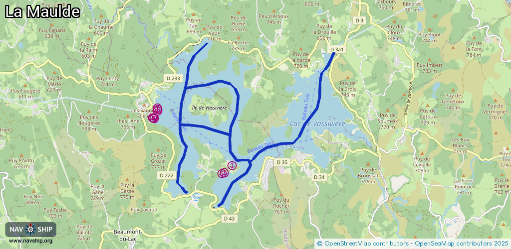
Waterway information

Kind:
Inland
Driving areas:
🇫🇷 France
Length:
15.1 km¹
¹River kilometers or bank length recorded in NavShip, including river arms and harbor entrances.
Availability:
Completely recorded
Recent Update: 14.08.2025²
² This date indicates when an adjustment last took place in the course of the body of water
Recorded:
Locks: 0
Harbours / marinas: 9
Bridges: 0
Berths: 0
Slipways: 0
Fuelstations: 0
Route:
Please wait, loading route graphic...
Request waterway overview map with symbol legend here (Link).
Information about data associated with this body of water (9 available):
Data by OpenSeaMap (c) OSM contributors, www.openseamap.org
| # | Kind | Coordinates | Name | Information |
|---|---|---|---|---|
| 1 | Marina | 45.79913,1.84387 | 2025-08-10T17:30:48Z | |
| 2 | Marina | 45.7992,1.84421 | 2025-08-10T17:30:48Z | |
| 3 | Marina | 45.79913,1.84453 | 2025-08-10T17:30:48Z | |
| 4 | Marina | 45.80152,1.84561 | 2025-08-10T17:30:48Z | |
| 5 | Marina | 45.80121,1.84575 | 2025-08-10T17:30:48Z | |
| 6 | Marina | 45.80088,1.84575 | 2025-08-10T17:30:48Z | |
| 7 | Marina | 45.78771,1.8713 | 2025-08-10T17:30:48Z | |
| 8 | Marina | 45.78597,1.86857 | 2025-08-10T17:30:48Z | |
| 9 | Marina | 45.78578,1.86787 | 2025-08-10T17:30:48Z |