Waterway information

Kind:
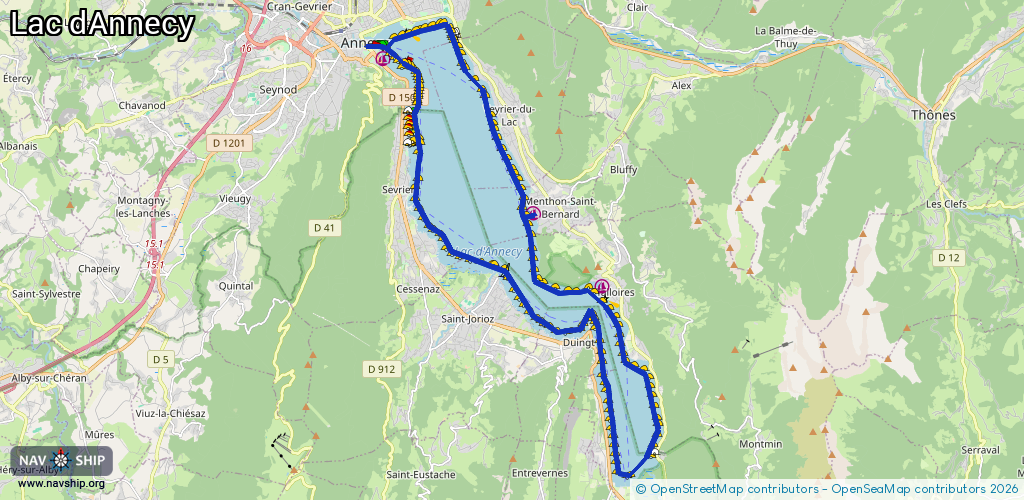
Lake
Driving areas:
🇫🇷 France
Length:
33.2 km¹
¹River kilometers or bank length recorded in NavShip, including river arms and harbor entrances.
Availability:
Completely recorded
Recent Update: 25.07.2023²
² This date indicates when an adjustment last took place in the course of the body of water
Recorded:
Locks: 0
Harbours / marinas: 3
Bridges: 0
Berths: 0
Slipways: 1
Fuelstations: 0
Route:
Please wait, loading route graphic...
Request waterway overview map with symbol legend here (Link).
Information about data associated with this body of water (4 available):
Data by OpenSeaMap (c) OSM contributors, www.openseamap.org
| # | Kind | Coordinates | Name | Information |
|---|---|---|---|---|
| 1 | Marina | 45.89524,6.13509 | 2025-12-09T10:42:36Z | Port d'Annecy |
| 2 | Marina | 45.84056,6.21045 | 2025-04-16T14:16:33Z | Port de l'Abbaye |
| 3 | Marina | 45.85835,6.1868 | 2022-02-22T16:09:28Z | |
| 4 | Slipway | 45.84022,6.2106 | Unknown | 2022-03-08T16:56:48Z |