Waterway information

Kind:
Lake
Driving areas:
🇨🇭 Switzerland
Length:
91.6 km¹
¹River kilometers or bank length recorded in NavShip, including river arms and harbor entrances.
Availability:
Completely recorded
Recent Update: 22.02.2026²
² This date indicates when an adjustment last took place in the course of the body of water
Recorded:
Locks: 0
Harbours / marinas: 14
Bridges: 0
Berths: 0
Slipways: 0
Fuelstations: 0
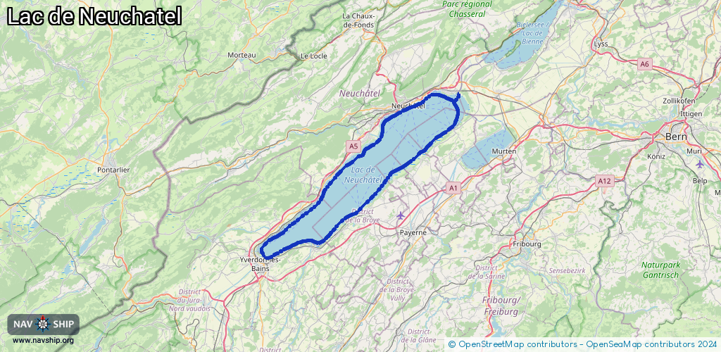
Route:
Please wait, loading route graphic...
Request waterway overview map with symbol legend here (Link).
Information about data associated with this body of water (14 available):
Data by OpenSeaMap (c) OSM contributors, www.openseamap.org
| # | Kind | Coordinates | Name | Information |
|---|---|---|---|---|
| 1 | Marina | 46.82027,6.78223 | 2021-07-31T11:28:17Z | Port de Cheyres |
| 2 | Marina | 46.82167,6.78276 | 2017-08-07T11:54:08Z | Cheyres |
| 3 | Marina | 46.85217,6.83684 | 2017-06-29T16:45:46Z | Estavayer |
| 4 | Marina | 46.85094,6.8389 | 2024-01-25T15:02:16Z | Port d'Estavayer [email protected] +41 26 663 35 87 https://www.socoop.org/fr/index.htm |
| 5 | Marina | 46.92591,6.95486 | 2018-09-17T15:57:41Z | Port de Portalban |
| 6 | Marina | 46.80463,6.64084 | 2021-08-09T12:10:18Z | Port de Grandson |
| 7 | Marina | 46.93887,6.85298 | 2020-08-10T15:38:18Z | Port de Cortaillod |
| 8 | Marina | 46.94346,6.8645 | 2020-08-10T15:38:18Z | Port Bovet |
| 9 | Marina | 46.99027,6.93383 | 2024-09-08T20:14:31Z | Port de Neuchâtel Port de Neuchâtel |
| 10 | Marina | 46.99061,6.93611 | 2025-05-08T00:22:50Z | Port des Jeunes-Rives |
| 11 | Marina | 46.99029,6.93596 | 2022-03-03T21:23:01Z | |
| 12 | Marina | 46.9957,6.95001 | 2025-05-08T00:22:50Z | Port du Nid du Crõ |
| 13 | Marina | 46.99507,6.94906 | 2025-05-08T00:22:50Z | |
| 14 | Marina | 47.00996,6.9847 | 2025-04-29T11:31:34Z | Port de Saint-Blaise |