Waterway information

Kind:
Inland
Driving areas:
🇳🇱 Netherlands
Length:
5.5 km¹
¹River kilometers or bank length recorded in NavShip, including river arms and harbor entrances.
Availability:
Completely recorded
Recent Update: 27.01.2023²
² This date indicates when an adjustment last took place in the course of the body of water
Recorded:
Locks: 0
Harbours / marinas: 2
Bridges: 6
Berths: 0
Slipways: 0
Fuelstations: 0
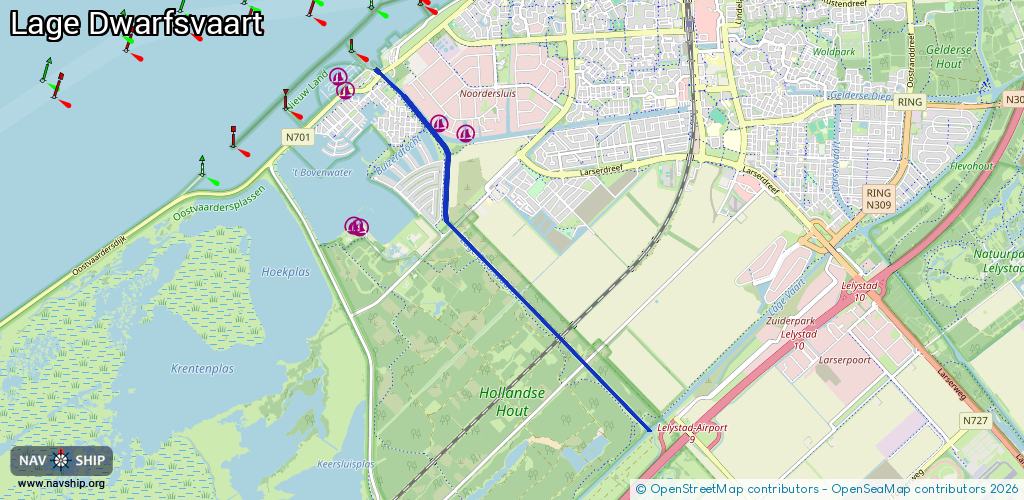
Route:
Please wait, loading route graphic...
Request waterway overview map with symbol legend here (Link).
Information about data associated with this body of water (8 available):
Data by OpenSeaMap (c) OSM contributors, www.openseamap.org
| # | Kind | Coordinates | Name | Information |
|---|---|---|---|---|
| 1 | Marina | 52.49753,5.42985 | 2022-05-12T11:50:41Z | |
| 2 | Marina | 52.49648,5.4344 | 2022-05-12T11:50:41Z | |
| 3 | Bridge | 52.50269,5.41985 | 8.5 | Clearance height: 2022-06-06T07:31:03Z m Maximum passage width: 6.5 m Movable bridge (e.g. lifting bridge or drawbridge) opening |
| 4 | Bridge | 52.49439,5.4314 | 37.5 | Clearance height: 2020-05-14T15:54:11Z m Maximum passage width: 6.5 m Movable bridge (e.g. lifting bridge or drawbridge) fixed |
| 5 | Bridge | 52.48663,5.43217 | 22 | Clearance height: 2013-02-04T13:22:41Z m Maximum passage width: 6.5 m Movable bridge (e.g. lifting bridge or drawbridge) fixed |
| 6 | Bridge | 52.47514,5.45057 | 30.8 | Clearance height: 2013-02-04T13:22:41Z m Maximum passage width: 6.7 m Movable bridge (e.g. lifting bridge or drawbridge) fixed |
| 7 | Bridge | 52.47247,5.45484 | 22 | Clearance height: 2014-10-13T14:16:23Z m Maximum passage width: 6.5 m Movable bridge (e.g. lifting bridge or drawbridge) fixed |
| 8 | Bridge | 52.4665,5.46433 | Unknown | Clearance height: 2013-02-04T13:22:41Z m Maximum passage width: 7.6 m Movable bridge (e.g. lifting bridge or drawbridge) fixed |