Waterway information

Kind:
Inland
Driving areas:
🇦🇷 Argentina
Length:
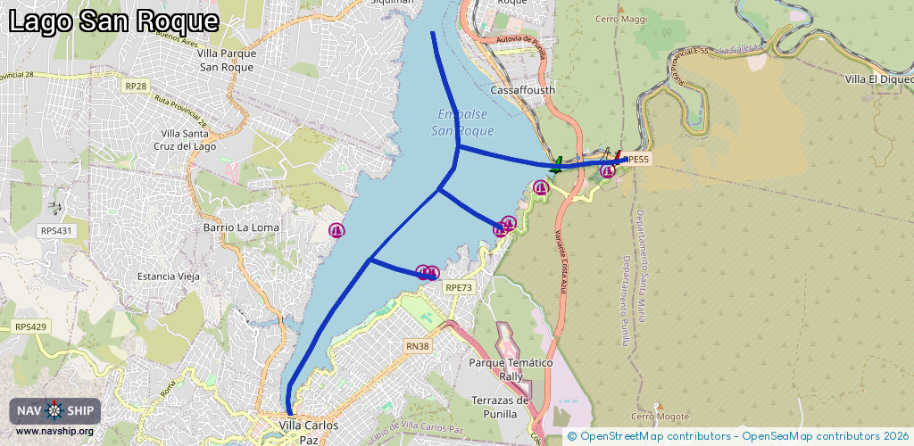
13.8 km¹
¹River kilometers or bank length recorded in NavShip, including river arms and harbor entrances.
Availability:
Completely recorded
Recent Update: 05.11.2024²
² This date indicates when an adjustment last took place in the course of the body of water
Recorded:
Locks: 0
Harbours / marinas: 6
Bridges: 0
Berths: 0
Slipways: 0
Fuelstations: 0
Route:
Please wait, loading route graphic...
Request waterway overview map with symbol legend here (Link).
Information about data associated with this body of water (6 available):
Data by OpenSeaMap (c) OSM contributors, www.openseamap.org
| # | Kind | Coordinates | Name | Information |
|---|---|---|---|---|
| 1 | Marina | -31.3754,-64.4362 | 2020-12-19T05:50:27Z | Muelle San Roque |
| 2 | Marina | -31.39223,-64.47 | 2022-11-11T03:21:44Z | |
| 3 | Marina | -31.39214,-64.47167 | 2020-09-07T12:08:14Z | |
| 4 | Marina | -31.38522,-64.48831 | 2020-09-07T12:38:45Z | |
| 5 | Marina | -31.38413,-64.45529 | 2022-11-11T02:20:59Z | |
| 6 | Marina | -31.38513,-64.4568 | 2020-12-19T05:50:27Z |