Waterway information

Kind:
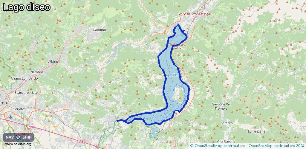
Lake
Driving areas:
🇮🇹 Italy
Length:
65.2 km¹
¹River kilometers or bank length recorded in NavShip, including river arms and harbor entrances.
Availability:
Completely recorded
Recent Update: 22.02.2026²
² This date indicates when an adjustment last took place in the course of the body of water
Recorded:
Locks: 0
Harbours / marinas: 9
Bridges: 0
Berths: 0
Slipways: 1
Fuelstations: 0
Route:
Please wait, loading route graphic...
Request waterway overview map with symbol legend here (Link).
Information about data associated with this body of water (10 available):
Data by OpenSeaMap (c) OSM contributors, www.openseamap.org
| # | Kind | Coordinates | Name | Information |
|---|---|---|---|---|
| 1 | Marina | 45.82089,10.08017 | 2021-01-11T15:37:25Z | |
| 2 | Marina | 45.80906,10.06981 | 2024-11-11T15:24:23Z | Porto Turistico di Lovere |
| 3 | Marina | 45.80931,10.07002 | 2022-11-18T16:26:54Z | Porto turistico di Lovere |
| 4 | Marina | 45.80471,10.10515 | 2016-06-29T21:21:41Z | Porto di Pisogne |
| 5 | Marina | 45.79925,10.10399 | 2016-06-16T01:41:14Z | |
| 6 | Marina | 45.69089,10.0996 | 2024-01-20T12:15:28Z | Sulzano |
| 7 | Marina | 45.6892,10.09861 | 2024-01-25T10:39:13Z | Porto vecchio |
| 8 | Marina | 45.67919,10.08409 | 2024-01-25T10:51:25Z | Associazione Nautica Sebina (ANS) |
| 9 | Marina | 45.66382,10.05122 | 2022-10-13T15:17:17Z | |
| 10 | Slipway | 45.80815,10.07007 | small_craft_facility | 2016-06-16T01:41:16Z |