Waterway information

Kind:
Inland
Driving areas:
🇺🇸 United States of America
Length:
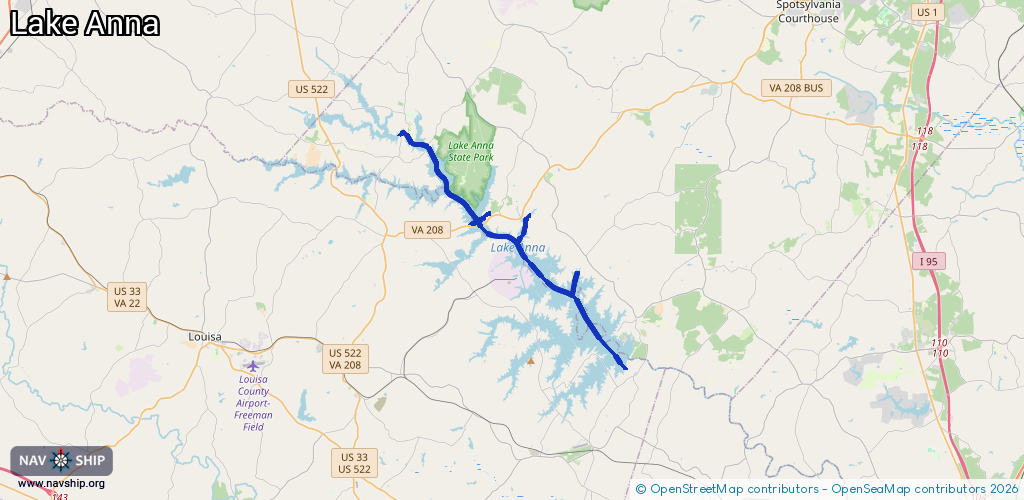
25.6 km¹
¹River kilometers or bank length recorded in NavShip, including river arms and harbor entrances.
Availability:
Completely recorded
Recent Update: 25.01.2024²
² This date indicates when an adjustment last took place in the course of the body of water
Recorded:
Locks: 0
Harbours / marinas: 9
Bridges: 0
Berths: 0
Slipways: 0
Fuelstations: 0
Route:
Please wait, loading route graphic...
Request waterway overview map with symbol legend here (Link).
Information about data associated with this body of water (9 available):
Data by OpenSeaMap (c) OSM contributors, www.openseamap.org
| # | Kind | Coordinates | Name | Information |
|---|---|---|---|---|
| 1 | Marina | 38.08989,-77.81075 | 2023-09-19T18:12:19Z | Anna Point Marina https://annapoint.com/ |
| 2 | Marina | 38.0883,-77.81056 | 2023-09-19T18:12:19Z | High Point Marina https://www.highpointmarina.com/ |
| 3 | Marina | 38.1342,-77.86835 | 2023-09-24T12:56:44Z | Hunters Landing https://www.thecovelka.com/hunters-landing |
| 4 | Marina | 38.08547,-77.82123 | 2023-04-13T19:05:38Z | |
| 5 | Marina | 38.08574,-77.82059 | 2023-09-14T05:19:40Z | |
| 6 | Marina | 38.08555,-77.82087 | 2023-04-13T19:05:38Z | |
| 7 | Marina | 38.09046,-77.78407 | 2023-10-06T18:33:09Z | Sturgeon Creek Marina |
| 8 | Marina | 38.07994,-77.78207 | 2023-10-30T14:06:00Z | Lake Anna Marina https://lakeannamarina.net/ |
| 9 | Marina | 38.06044,-77.74982 | 2023-11-03T14:39:21Z | Dukes Creek Marina https://dukescreekmarina.com/ |