Waterway information

Kind:
Inland
Driving areas:
🇺🇸 United States of America
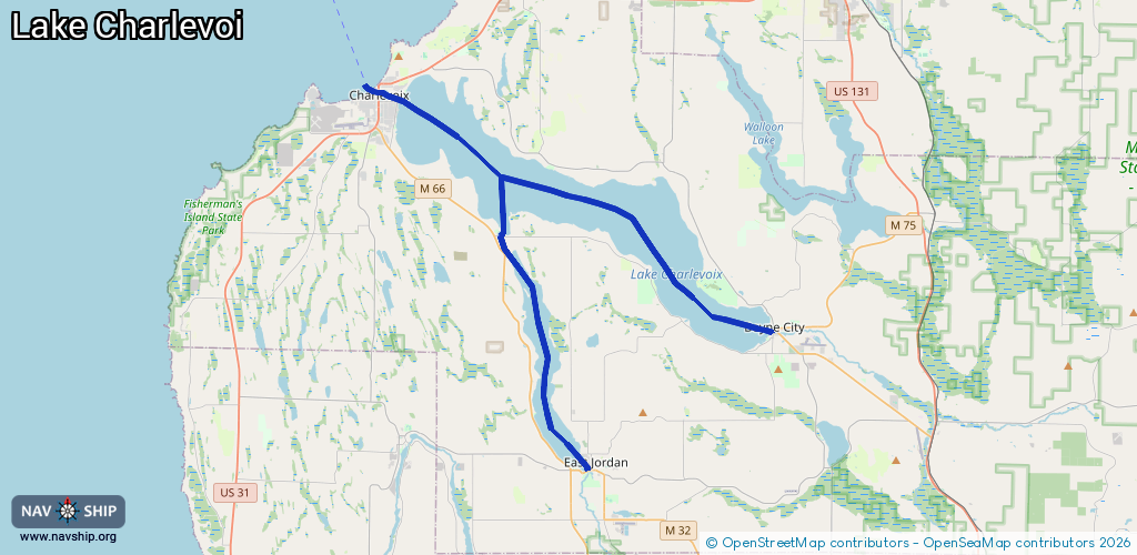
Length:
39.5 km¹
¹River kilometers or bank length recorded in NavShip, including river arms and harbor entrances.
Availability:
Completely recorded
Recent Update: 30.04.2025²
² This date indicates when an adjustment last took place in the course of the body of water
Recorded:
Locks: 0
Harbours / marinas: 5
Bridges: 0
Berths: 0
Slipways: 0
Fuelstations: 1
Route:
Please wait, loading route graphic...
Request waterway overview map with symbol legend here (Link).
Information about data associated with this body of water (6 available):
Data by OpenSeaMap (c) OSM contributors, www.openseamap.org
| # | Kind | Coordinates | Name | Information |
|---|---|---|---|---|
| 1 | Marina | 45.1547,-85.12952 | 2022-02-16T13:35:29Z | East Jordan City Marina +1 231 536 2166 https://eastjordancity.org/city/parks-recreation/municipal-harbor-marina/ |
| 2 | Marina | 45.216,-85.01679 | 2021-03-11T16:40:22Z | |
| 3 | Marina | 45.21043,-85.02093 | 2021-03-11T16:40:22Z | The Harborage +1 231 582 3340 https://harboragemarina.net/ |
| 4 | Marina | 45.21956,-85.06813 | 2020-12-13T05:48:45Z | Sommerset Pointe Yacht Club & Marina +1-231-582-9900 http://www.sommersetpointe.com/ |
| 5 | Marina | 45.31503,-85.25787 | 2023-08-22T19:52:23Z | Ward Brothers Boats +1 231 547 2371 https://www.wardbrothersboats.com/ |
| 6 | Fuel station | 45.31557,-85.25748 | 2022-11-11T12:32:51Z |