Waterway information

Kind:
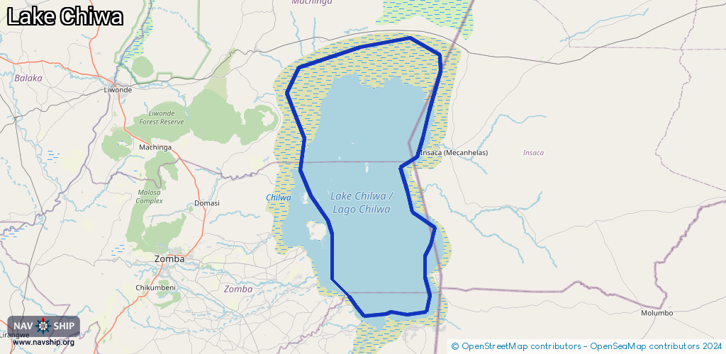
Lake
Driving areas:
Other areas
Length:
160.8 km¹
¹River kilometers or bank length recorded in NavShip, including river arms and harbor entrances.
Availability:
Completely recorded
Recent Update: 28.11.2024²
² This date indicates when an adjustment last took place in the course of the body of water
Recorded:
Locks: 0
Harbours / marinas: 2
Bridges: 0
Berths: 0
Slipways: 2
Fuelstations: 0
Route:
Please wait, loading route graphic...
Request waterway overview map with symbol legend here (Link).
Information about data associated with this body of water (4 available):
Data by OpenSeaMap (c) OSM contributors, www.openseamap.org
| # | Kind | Coordinates | Name | Information |
|---|---|---|---|---|
| 1 | Marina | -15.45689,35.66949 | 2023-03-21T08:26:29Z | |
| 2 | Marina | -15.47435,35.68306 | 2023-03-20T11:27:57Z | |
| 3 | Slipway | -15.45693,35.66944 | Unknown | 2020-03-04T10:01:28Z |
| 4 | Slipway | -15.47448,35.68281 | Unknown | 2020-03-04T10:01:28Z |