Waterway information

Kind:
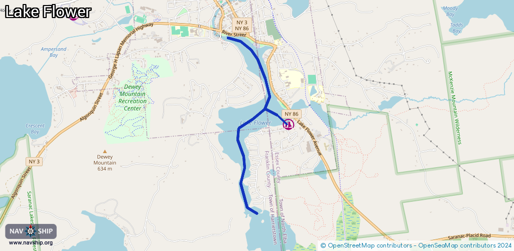
Inland
Driving areas:
🇺🇸 United States of America
Length:
3.3 km¹
¹River kilometers or bank length recorded in NavShip, including river arms and harbor entrances.
Availability:
Completely recorded
Recent Update: 27.02.2024²
² This date indicates when an adjustment last took place in the course of the body of water
Recorded:
Locks: 0
Harbours / marinas: 4
Bridges: 0
Berths: 0
Slipways: 1
Fuelstations: 0
Route:
Please wait, loading route graphic...
Request waterway overview map with symbol legend here (Link).
Information about data associated with this body of water (5 available):
Data by OpenSeaMap (c) OSM contributors, www.openseamap.org
| # | Kind | Coordinates | Name | Information |
|---|---|---|---|---|
| 1 | Marina | 44.32106,-74.12417 | 2024-10-04T12:24:27Z | Mountain Mist Boat Dock |
| 2 | Marina | 44.32168,-74.12429 | 2024-10-10T02:06:25Z | Fogarty's Lake Flower Marina |
| 3 | Marina | 44.32313,-74.12561 | 2025-01-19T22:29:05Z | Lake Flower Boat Launch https://www.dec.ny.gov/outdoor/23896.html |
| 4 | Marina | 44.31354,-74.12019 | 2022-10-13T06:02:04Z | Swiss Marine Inc |
| 5 | Slipway | 44.32333,-74.12613 | Unknown | 2025-05-01T14:32:21Z Lake Flower Boat Launch |