Waterway information

Kind:
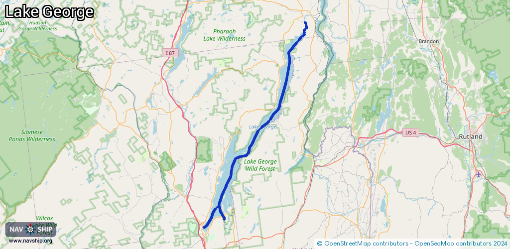
Inland
Driving areas:
🇺🇸 United States of America
Length:
60 km¹
¹River kilometers or bank length recorded in NavShip, including river arms and harbor entrances.
Availability:
Completely recorded
Recent Update: 27.02.2026²
² This date indicates when an adjustment last took place in the course of the body of water
Recorded:
Locks: 0
Harbours / marinas: 4
Bridges: 1
Berths: 2
Slipways: 0
Fuelstations: 0
Route:
Please wait, loading route graphic...
Request waterway overview map with symbol legend here (Link).
Information about data associated with this body of water (7 available):
Data by OpenSeaMap (c) OSM contributors, www.openseamap.org
| # | Kind | Coordinates | Name | Information |
|---|---|---|---|---|
| 1 | Marina | 43.42605,-73.71019 | 2021-05-31T18:37:44Z | |
| 2 | Marina | 43.75754,-73.48103 | 2026-01-31T19:31:56Z | Northern Lake George Yacht Club |
| 3 | Marina | 43.41906,-73.69888 | 2026-02-22T16:55:51Z | Halls Boat Corp https://www.hallsboat.com/ |
| 4 | Marina | 43.64447,-73.50635 | 2026-02-02T18:25:50Z | Huletts Landing Marina +1-518-499-0801 http://hulettsmarina.com/ |
| 5 | Bridge | 43.44219,-73.6533 | Unknown | Clearance height: 2025-07-07T02:46:19Z m Maximum passage width: 59 m Movable bridge (e.g. lifting bridge or drawbridge) |
| 6 | Berth | 43.49243,-73.67596 | 2012-12-14T14:27:51Z | |
| 7 | Berth | 43.49775,-73.67356 | 2012-12-22T12:31:30Z |