Waterway information

Kind:
Inland
Driving areas:
🇺🇸 United States of America
Length:
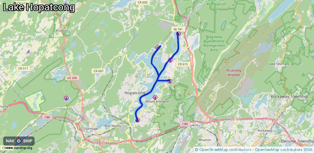
14.7 km¹
¹River kilometers or bank length recorded in NavShip, including river arms and harbor entrances.
Availability:
Completely recorded
Recent Update: 02.04.2024²
² This date indicates when an adjustment last took place in the course of the body of water
Recorded:
Locks: 0
Harbours / marinas: 6
Bridges: 0
Berths: 0
Slipways: 0
Fuelstations: 0
Route:
Please wait, loading route graphic...
Request waterway overview map with symbol legend here (Link).
Information about data associated with this body of water (6 available):
Data by OpenSeaMap (c) OSM contributors, www.openseamap.org
| # | Kind | Coordinates | Name | Information |
|---|---|---|---|---|
| 1 | Marina | 40.9714,-74.63474 | 2023-04-17T14:24:54Z | Lolas Marina |
| 2 | Marina | 40.9101,-74.65683 | 2026-01-07T03:47:13Z | Shorehills Beach and Marina |
| 3 | Marina | 40.92923,-74.63789 | 2025-12-27T23:47:41Z | Barnes Brother Marine +1 973-398-0251 http://barnesbrosmarine.com/ |
| 4 | Marina | 40.96072,-74.62044 | 2023-04-17T14:24:54Z | Bridge Marina Marina/Boat Rentals |
| 5 | Marina | 40.98299,-74.6113 | 2023-04-17T14:24:54Z | 3 Peaks Marina |
| 6 | Marina | 40.94312,-74.62098 | 2024-03-31T04:51:16Z | Lake Hopatcong Marine (at Sand Bar) https://www.lakehopatcongmarine.com/ |