Waterway information

Kind:
Inland
Driving areas:
🇺🇸 United States of America
Length:
179.4 km¹
¹River kilometers or bank length recorded in NavShip, including river arms and harbor entrances.
Availability:
Completely recorded
Recent Update: 01.04.2025²
² This date indicates when an adjustment last took place in the course of the body of water
Recorded:
Locks: 0
Harbours / marinas: 12
Bridges: 0
Berths: 0
Slipways: 0
Fuelstations: 0
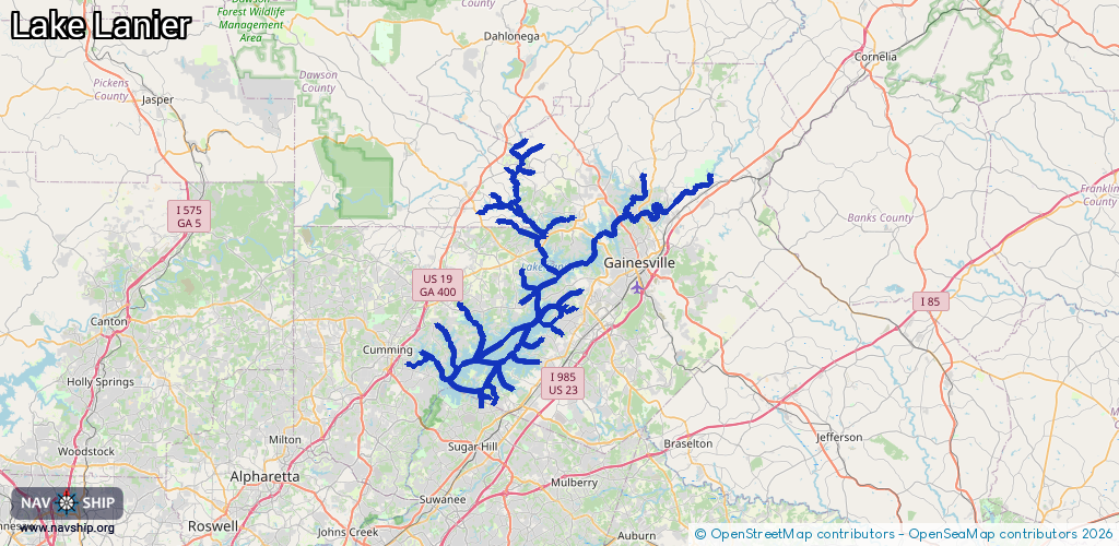
Route:
Please wait, loading route graphic...
Request waterway overview map with symbol legend here (Link).
Information about data associated with this body of water (12 available):
Data by OpenSeaMap (c) OSM contributors, www.openseamap.org
| # | Kind | Coordinates | Name | Information |
|---|---|---|---|---|
| 1 | Marina | 34.17239,-84.00392 | 2025-01-14T23:39:41Z | Holiday On Lake Lanier https://holidaylakelanier.com/ |
| 2 | Marina | 34.20705,-84.10125 | 2023-10-06T19:54:11Z | Bald Ridge Marina |
| 3 | Marina | 34.24878,-83.96087 | 2023-10-06T19:58:08Z | Port Royale |
| 4 | Marina | 34.23768,-83.93683 | 2025-01-14T23:07:31Z | Sunrise Cove Marina https://sunrisecovemarina.com/ |
| 5 | Marina | 34.32834,-83.94298 | 2024-04-08T15:16:51Z | |
| 6 | Marina | 34.32863,-83.94379 | 2024-04-08T15:16:51Z | |
| 7 | Marina | 34.32855,-83.94338 | 2024-04-08T15:16:51Z | |
| 8 | Marina | 34.3263,-83.943 | 2024-04-08T15:16:51Z | |
| 9 | Marina | 34.32588,-83.94264 | 2024-04-08T15:16:51Z | |
| 10 | Marina | 34.32626,-83.94413 | 2024-04-08T15:16:51Z | |
| 11 | Marina | 34.32641,-83.94351 | 2024-04-08T15:16:51Z | |
| 12 | Marina | 34.32593,-83.94488 | 2024-04-08T15:16:51Z |