Waterway information

Kind:
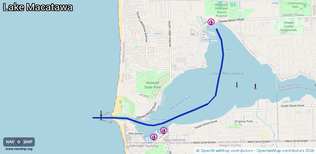
Inland
Driving areas:
🇺🇸 United States of America
Length:
4.6 km¹
¹River kilometers or bank length recorded in NavShip, including river arms and harbor entrances.
Availability:
Completely recorded
Recent Update: 20.02.2024²
² This date indicates when an adjustment last took place in the course of the body of water
Recorded:
Locks: 0
Harbours / marinas: 3
Bridges: 0
Berths: 0
Slipways: 1
Fuelstations: 1
Route:
Please wait, loading route graphic...
Request waterway overview map with symbol legend here (Link).
Information about data associated with this body of water (5 available):
Data by OpenSeaMap (c) OSM contributors, www.openseamap.org
| # | Kind | Coordinates | Name | Information |
|---|---|---|---|---|
| 1 | Marina | 42.79265,-86.18554 | 2024-01-09T14:33:57Z | Anchorage Marina & Yacht Club +1-616-399-1802 https://.anchoragemarine.com |
| 2 | Marina | 42.76995,-86.19817 | 2025-06-29T16:08:53Z | Macatawa Bay Yacht Club +1-616-335-5815 https://www.mbyc.com |
| 3 | Marina | 42.76871,-86.20168 | 2025-06-29T16:08:53Z | Eldean Shipyard +1 616 335 5843 http://www.eldean.com/ |
| 4 | Slipway | 42.78991,-86.18591 | Unknown | 2025-06-21T17:31:43Z |
| 5 | Fuel station | 42.78988,-86.18389 | 2025-06-21T17:31:43Z |