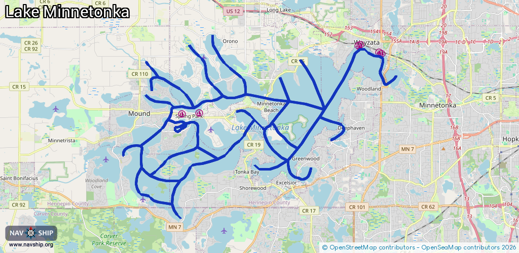
Waterway information

Kind:
Inland
Driving areas:
🇺🇸 United States of America
Length:
79 km¹
¹River kilometers or bank length recorded in NavShip, including river arms and harbor entrances.
Availability:
Completely recorded
Recent Update: 01.04.2025²
² This date indicates when an adjustment last took place in the course of the body of water
Recorded:
Locks: 0
Harbours / marinas: 6
Bridges: 0
Berths: 0
Slipways: 0
Fuelstations: 1
Route:
Please wait, loading route graphic...
Request waterway overview map with symbol legend here (Link).
Information about data associated with this body of water (7 available):
Data by OpenSeaMap (c) OSM contributors, www.openseamap.org
| # | Kind | Coordinates | Name | Information |
|---|---|---|---|---|
| 1 | Marina | 44.93682,-93.6256 | 2024-08-21T20:23:35Z | Rockvam Boat Yards, Inc. |
| 2 | Marina | 44.93627,-93.63723 | 2024-08-25T20:02:57Z | Blue Lagoon Marina |
| 3 | Marina | 44.96904,-93.51747 | 2023-09-08T13:31:22Z | |
| 4 | Marina | 44.96947,-93.51621 | 2023-09-08T13:31:22Z | Depot Docks |
| 5 | Marina | 44.96547,-93.50203 | 2023-09-08T12:56:18Z | Wayzata Yacht Club |
| 6 | Marina | 44.96595,-93.50375 | 2023-09-08T12:56:18Z | Wayzata Community Sailing Center |
| 7 | Fuel station | 44.93823,-93.64655 | 2024-08-21T20:23:35Z | Metro Lakes Marina & Rentals LLC. |