Waterway information

Kind:
Inland
Driving areas:
🇺🇸 United States of America
Length:
38 km¹
¹River kilometers or bank length recorded in NavShip, including river arms and harbor entrances.
Availability:
Completely recorded
Recent Update: 20.12.2023²
² This date indicates when an adjustment last took place in the course of the body of water
Recorded:
Locks: 0
Harbours / marinas: 7
Bridges: 0
Berths: 0
Slipways: 2
Fuelstations: 1
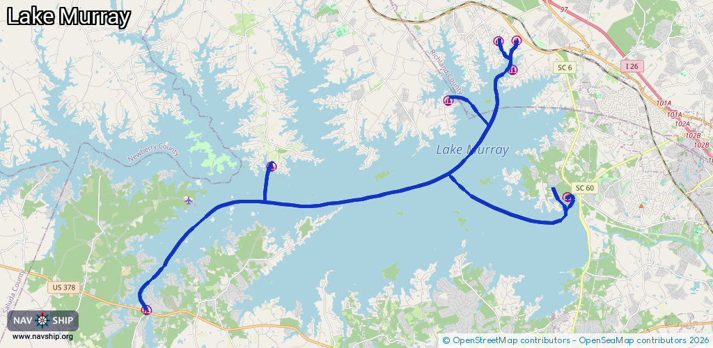
Route:
Please wait, loading route graphic...
Request waterway overview map with symbol legend here (Link).
Information about data associated with this body of water (10 available):
Data by OpenSeaMap (c) OSM contributors, www.openseamap.org
| # | Kind | Coordinates | Name | Information |
|---|---|---|---|---|
| 1 | Marina | 34.07797,-81.37349 | 2020-05-19T23:13:45Z | Timberlake Marina |
| 2 | Marina | 34.10471,-81.28621 | 2021-08-13T01:53:34Z | Lake Murray Sailing Club |
| 3 | Marina | 34.06557,-81.22708 | 2020-05-19T23:13:45Z | |
| 4 | Marina | 34.01914,-81.435 | 2025-11-09T17:57:55Z | Southshore Marina +1-803-532-4231 https://www.southshoresc.com/ |
| 5 | Marina | 34.11709,-81.25424 | 2023-09-24T08:32:30Z | Lake Murray Marina |
| 6 | Marina | 34.12931,-81.25243 | 2022-08-20T23:29:21Z | |
| 7 | Marina | 34.12911,-81.26148 | 2022-08-20T23:27:38Z | |
| 8 | Slipway | 34.11708,-81.2538 | Unknown | 2022-08-20T23:33:26Z |
| 9 | Slipway | 34.12932,-81.25196 | Unknown | 2022-08-20T23:29:21Z |
| 10 | Fuel station | 34.01983,-81.43528 | 2023-01-20T18:25:04Z |