Waterway information

Kind:
Inland
Driving areas:
🇺🇸 United States of America
Length:
23.2 km¹
¹River kilometers or bank length recorded in NavShip, including river arms and harbor entrances.
Availability:
Completely recorded
Recent Update: 01.04.2025²
² This date indicates when an adjustment last took place in the course of the body of water
Recorded:
Locks: 0
Harbours / marinas: 8
Bridges: 0
Berths: 0
Slipways: 1
Fuelstations: 0
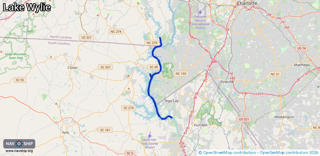
Route:
Please wait, loading route graphic...
Request waterway overview map with symbol legend here (Link).
Information about data associated with this body of water (9 available):
Data by OpenSeaMap (c) OSM contributors, www.openseamap.org
| # | Kind | Coordinates | Name | Information |
|---|---|---|---|---|
| 1 | Marina | 35.10159,-81.05836 | 2024-06-26T07:10:10Z | River Hills Marina https://www.riverhillsmarina.com/ |
| 2 | Marina | 35.16109,-81.03579 | 2022-08-05T20:03:36Z | Harbortowne Marina |
| 3 | Marina | 35.12038,-81.03151 | 2024-09-11T19:54:38Z | |
| 4 | Marina | 35.11837,-81.03098 | 2024-12-29T02:06:52Z | Terry's Marina |
| 5 | Marina | 35.11508,-81.02741 | 2024-09-14T16:46:32Z | |
| 6 | Marina | 35.10019,-81.03894 | 2020-11-24T02:49:46Z | The Carolina Boat Club |
| 7 | Marina | 35.04281,-81.04936 | 2022-06-29T05:31:20Z | |
| 8 | Marina | 35.03436,-81.03381 | 2023-10-27T17:17:09Z | Tega Cay Marina https://www.tegacaymarina.com/ |
| 9 | Slipway | 35.11562,-81.02559 | Unknown | 2024-09-14T16:46:32Z Long Cove Slipway |