Waterway information

Kind:
Inland
Driving areas:
🇩🇪 Germany
Length:
4.8 km¹
¹River kilometers or bank length recorded in NavShip, including river arms and harbor entrances.
Availability:
Completely recorded
Recent Update: 20.01.2024²
² This date indicates when an adjustment last took place in the course of the body of water
Recorded:
Locks: 0
Harbours / marinas: 2
Bridges: 0
Berths: 3
Slipways: 0
Fuelstations: 0
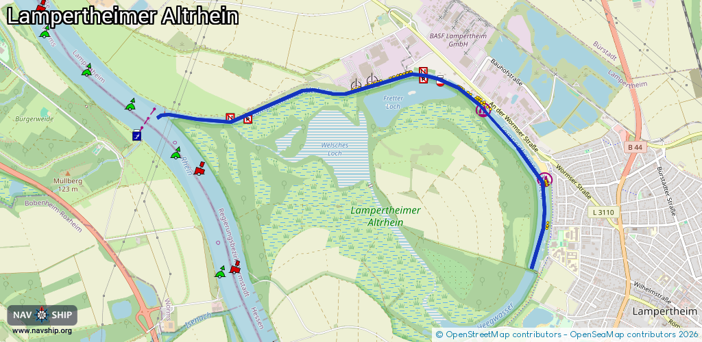
Route:
Please wait, loading route graphic...
Request waterway overview map with symbol legend here (Link).
Information about data associated with this body of water (5 available):
Data by OpenSeaMap (c) OSM contributors, www.openseamap.org
| # | Kind | Coordinates | Name | Information |
|---|---|---|---|---|
| 1 | Marina | 49.61083,8.44471 | 2014-12-24T09:27:36Z | Sportboothafen Lampertheimer Altrhein |
| 2 | Marina | 49.60515,8.4524 | 2019-03-05T07:00:19Z | Wassersportverein Lampertheim [email protected] +49 6206 4603 https://www.wsv-lampertheim.de/ |
| 3 | Berth | 49.613,8.43139 | 2025-08-16T08:01:00Z | unloading |
| 4 | Berth | 49.61287,8.43064 | 2025-08-16T08:01:00Z | unloading |
| 5 | Berth | 49.61255,8.42889 | 2025-08-16T08:01:00Z | unloading |