Waterway information

Kind:
Inland
Driving areas:
🇳🇱 Netherlands
Length:
4.9 km¹
¹River kilometers or bank length recorded in NavShip, including river arms and harbor entrances.
Availability:
Completely recorded
Recent Update: 26.09.2021²
² This date indicates when an adjustment last took place in the course of the body of water
Recorded:
Locks: 0
Harbours / marinas: 1
Bridges: 3
Berths: 1
Slipways: 1
Fuelstations: 0
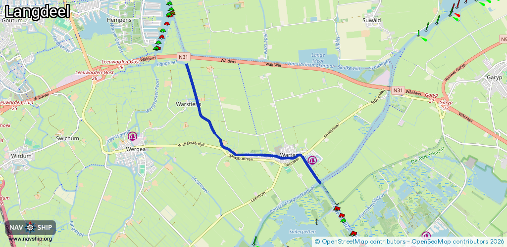
Route:
Please wait, loading route graphic...
Request waterway overview map with symbol legend here (Link).
Information about data associated with this body of water (6 available):
Data by OpenSeaMap (c) OSM contributors, www.openseamap.org
| # | Kind | Coordinates | Name | Information |
|---|---|---|---|---|
| 1 | Marina | 53.14928,5.90605 | 2023-05-30T12:17:23Z | Stichting Jachthaven Wartena [email protected] +31 58 255 1870 https://www.jachthavenwartena.nl/ |
| 2 | Bridge | 53.15013,5.90214 | 12.8 | Clearance height: 2020-05-08T07:25:19Z m Maximum passage width: 4.5 m Movable bridge (e.g. lifting bridge or drawbridge) fixed |
| 3 | Bridge | 53.15021,5.9023 | 8.00 | Clearance height: 2022-06-06T06:45:06Z m Maximum passage width: 4.3 m Movable bridge (e.g. lifting bridge or drawbridge) opening |
| 4 | Bridge | 53.14985,5.89775 | 7.4 | Clearance height: 2021-07-26T06:59:13Z m Maximum passage width: 0.7 m Movable bridge (e.g. lifting bridge or drawbridge) opening BB H7.5 W74 |
| 5 | Slipway | 53.15037,5.90422 | small_craft_facility | 2020-09-25T16:57:12Z |
| 6 | Berth | 53.15614,5.87057 | 2023-11-21T00:33:16Z | PR03 |