Waterway information

Kind:
Inland
Driving areas:
🇬🇧 United Kingdom
Length:
18.9 km¹
¹River kilometers or bank length recorded in NavShip, including river arms and harbor entrances.
Availability:
Completely recorded
Recent Update: 06.12.2023²
² This date indicates when an adjustment last took place in the course of the body of water
Recorded:
Locks: 1
Harbours / marinas: 2
Bridges: 3
Berths: 1
Slipways: 0
Fuelstations: 0
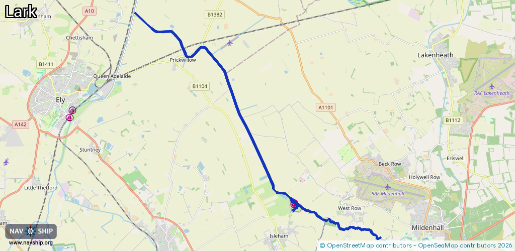
Route:
Please wait, loading route graphic...
Request waterway overview map with symbol legend here (Link).
Information about data associated with this body of water (6 available):
Data by OpenSeaMap (c) OSM contributors, www.openseamap.org
| # | Kind | Coordinates | Name | Information |
|---|---|---|---|---|
| 1 | Marina | 52.35573,0.42174 | 2023-11-27T20:17:25Z | Riverside Island Marina |
| 2 | Marina | 52.35527,0.42131 | 2024-03-06T22:55:07Z | Riverside Island Marina https://riversideisland.co.uk/ |
| 3 | Bridge | 52.41701,0.34773 | Unknown | Clearance height: 2021-06-04T08:13:38Z m Maximum passage width: 2.6 m Movable bridge (e.g. lifting bridge or drawbridge) |
| 4 | Bridge | 52.42015,0.3456 | Unknown | Clearance height: 2021-06-04T08:13:38Z m Maximum passage width: 3.1 m Movable bridge (e.g. lifting bridge or drawbridge) |
| 5 | Bridge | 52.43502,0.31299 | Unknown | Clearance height: 2021-05-21T08:51:56Z m Maximum passage width: 3.4 m Movable bridge (e.g. lifting bridge or drawbridge) |
| 6 | Berth | 52.35566,0.42214 | 2023-11-27T19:57:58Z | |
| 6 | Berth | 52.35566,0.42214 | 2023-11-27T19:57:58Z |