Waterway information

Kind:
Sea
Driving areas:
🇵🇱 Poland
Length:
2.6 km¹
¹River kilometers or bank length recorded in NavShip, including river arms and harbor entrances.
Availability:
Completely recorded
Recent Update: 25.07.2021²
² This date indicates when an adjustment last took place in the course of the body of water
Recorded:
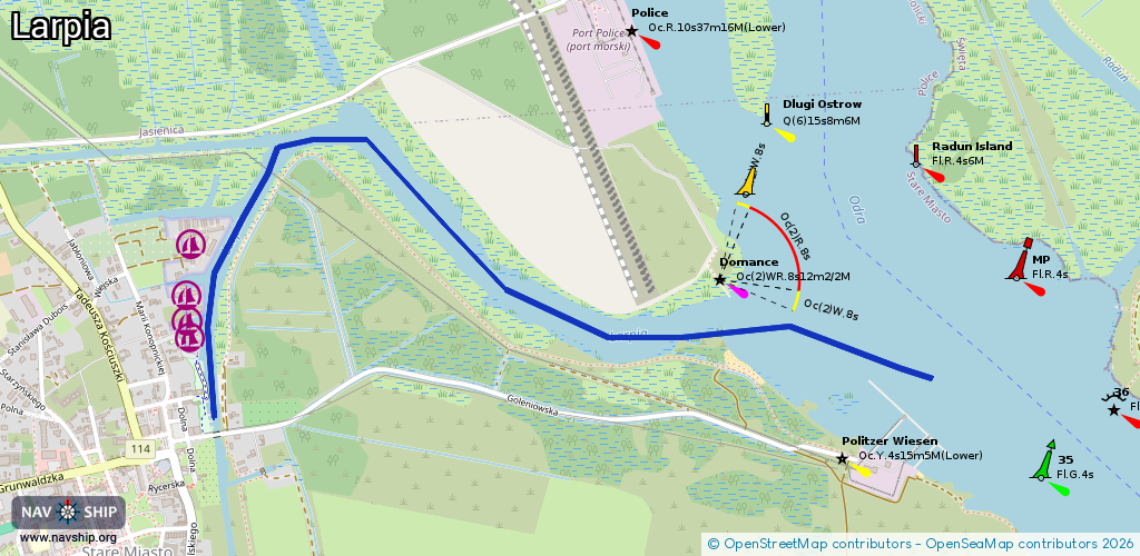
Locks: 0
Harbours / marinas: 3
Bridges: 1
Berths: 0
Slipways: 3
Fuelstations: 0
Route:
Please wait, loading route graphic...
Request waterway overview map with symbol legend here (Link).
Information about data associated with this body of water (7 available):
Data by OpenSeaMap (c) OSM contributors, www.openseamap.org
| # | Kind | Coordinates | Name | Information |
|---|---|---|---|---|
| 1 | Marina | 53.55518,14.57371 | 2024-06-18T14:29:04Z | WOPR Police +48 91 318 01 50 http://www.wopr.police.pl/ |
| 2 | Marina | 53.55569,14.5738 | 2024-06-18T14:29:04Z | Olimpia |
| 3 | Marina | 53.55476,14.57376 | 2025-07-18T13:23:07Z | Przystań Miejska |
| 4 | Bridge | 53.55863,14.57695 | Unknown | Clearance height: 2018-12-31T00:41:23Z m Maximum passage width: 7 m Movable bridge (e.g. lifting bridge or drawbridge) fixed |
| 5 | Slipway | 53.55561,14.57446 | small_craft_facility | 2017-03-03T15:04:14Z |
| 6 | Slipway | 53.55517,14.5739 | small_craft_facility | 2017-03-03T15:04:30Z |
| 7 | Slipway | 53.55662,14.57468 | small_craft_facility | 2018-01-12T18:18:18Z |