Waterway information

Kind:
Inland
Driving areas:
🇩🇪 Germany
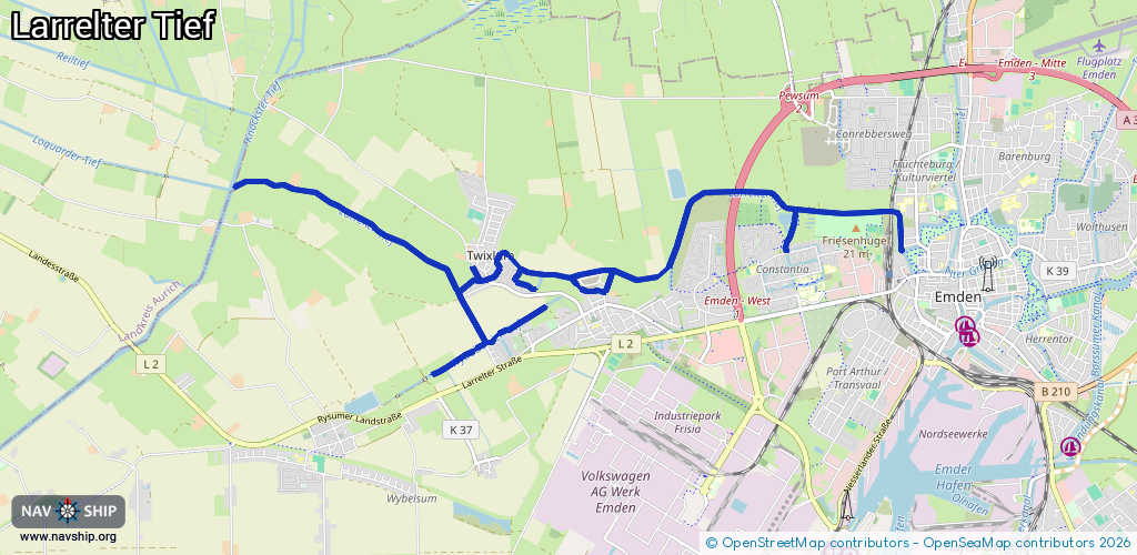
Length:
12.3 km¹
¹River kilometers or bank length recorded in NavShip, including river arms and harbor entrances.
Availability:
Completely recorded
Recent Update: 12.06.2023²
² This date indicates when an adjustment last took place in the course of the body of water
Recorded:
Locks: 0
Harbours / marinas: 0
Bridges: 7
Berths: 0
Slipways: 0
Fuelstations: 0
Route:
Please wait, loading route graphic...
Request waterway overview map with symbol legend here (Link).
Information about data associated with this body of water (7 available):
Data by OpenSeaMap (c) OSM contributors, www.openseamap.org
| # | Kind | Coordinates | Name | Information |
|---|---|---|---|---|
| 1 | Bridge | 53.36743,7.15096 | Unknown | Clearance height: 2014-05-01T20:28:18Z m Maximum passage width: 2.4 m fixed |
| 2 | Bridge | 53.36867,7.13316 | Unknown | Clearance height: 2016-07-19T12:21:22Z m Maximum passage width: 2 m fixed |
| 3 | Bridge | 53.36955,7.15083 | Unknown | Clearance height: 2014-05-01T20:28:18Z m Maximum passage width: 2 m fixed |
| 4 | Bridge | 53.37674,7.17178 | Unknown | Clearance height: 2014-05-01T20:28:19Z m Maximum passage width: 3 m fixed |
| 5 | Bridge | 53.37489,7.19534 | Unknown | Clearance height: 2024-07-08T11:47:53Z m Maximum passage width: 3 m fixed |
| 6 | Bridge | 53.37489,7.19551 | Unknown | Clearance height: 2024-07-08T11:47:53Z m Maximum passage width: 3 m fixed |
| 7 | Bridge | 53.37241,7.19688 | Unknown | Clearance height: 2014-05-01T20:28:28Z m Maximum passage width: 2.4 m fixed |