Waterway information

Kind:
Inland
Driving areas:
🇫🇷 France
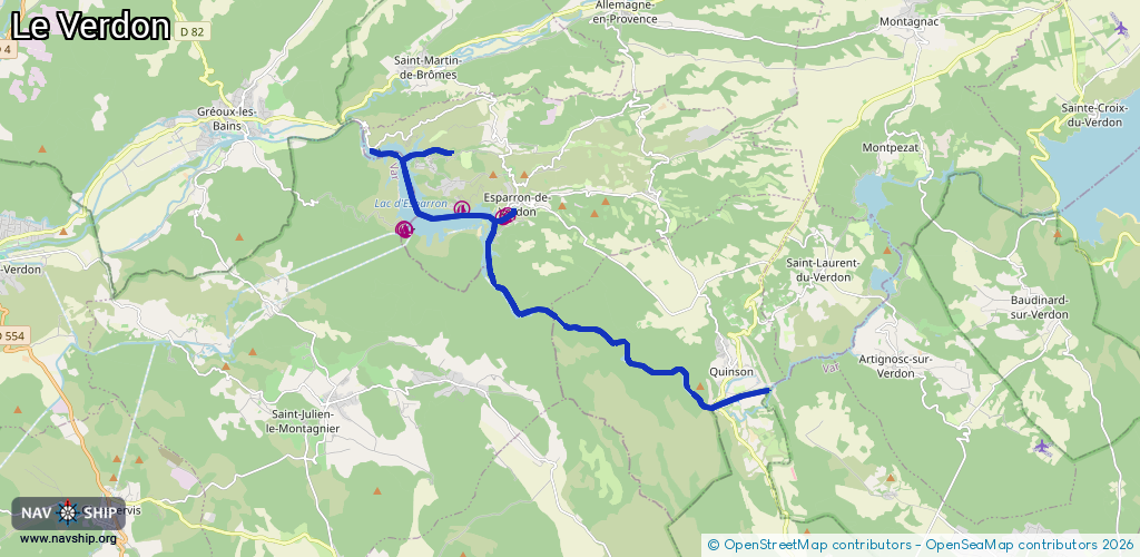
Length:
16.5 km¹
¹River kilometers or bank length recorded in NavShip, including river arms and harbor entrances.
Availability:
Completely recorded
Recent Update: 03.01.2024²
² This date indicates when an adjustment last took place in the course of the body of water
Recorded:
Locks: 0
Harbours / marinas: 5
Bridges: 0
Berths: 0
Slipways: 0
Fuelstations: 0
Route:
Please wait, loading route graphic...
Request waterway overview map with symbol legend here (Link).
Information about data associated with this body of water (5 available):
Data by OpenSeaMap (c) OSM contributors, www.openseamap.org
| # | Kind | Coordinates | Name | Information |
|---|---|---|---|---|
| 1 | Marina | 43.73356,5.93859 | 2024-09-05T12:58:16Z | |
| 2 | Marina | 43.73316,5.93924 | 2024-09-05T12:58:16Z | |
| 3 | Marina | 43.73801,5.95651 | 2024-05-23T13:34:41Z | Marina du domaine de Pierrelongue |
| 4 | Marina | 43.73603,5.96928 | 2023-11-11T12:51:35Z | |
| 5 | Marina | 43.7365,5.97057 | 2024-04-23T11:53:36Z |