Waterway information

Kind:
Inland
Driving areas:
🇺🇸 United States of America
Length:
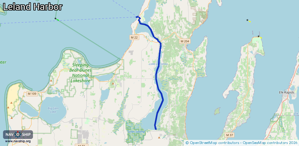
24.4 km¹
¹River kilometers or bank length recorded in NavShip, including river arms and harbor entrances.
Availability:
Completely recorded
Recent Update: 15.05.2025²
² This date indicates when an adjustment last took place in the course of the body of water
Recorded:
Locks: 0
Harbours / marinas: 6
Bridges: 0
Berths: 0
Slipways: 0
Fuelstations: 5
Route:
Please wait, loading route graphic...
Request waterway overview map with symbol legend here (Link).
Information about data associated with this body of water (11 available):
Data by OpenSeaMap (c) OSM contributors, www.openseamap.org
| # | Kind | Coordinates | Name | Information |
|---|---|---|---|---|
| 1 | Marina | 45.02535,-85.76275 | 2021-01-12T12:42:23Z | |
| 2 | Marina | 45.02412,-85.76327 | 2021-01-12T12:42:23Z | |
| 3 | Marina | 45.02434,-85.76218 | 2023-07-23T19:52:53Z | Leland Harbor +1 231 256 9132 https://www.lelandmi.com/harbor/leland-harbor.html |
| 4 | Marina | 45.01971,-85.75991 | 2023-05-08T18:54:51Z | Stander Marine +1 231 256 9231 https://www.standermarine.net/ |
| 5 | Marina | 45.01953,-85.75952 | 2025-07-05T14:57:18Z | |
| 6 | Marina | 44.98238,-85.71393 | 2022-06-10T00:55:55Z | The Narrows Yacht Club +1 231 994 2166 http://thenarrowsyachtclub.com/ |
| 7 | Fuel station | 45.02459,-85.76285 | 2023-05-08T18:54:51Z | |
| 8 | Fuel station | 45.01994,-85.75964 | 2023-05-08T18:54:51Z | |
| 9 | Fuel station | 45.01947,-85.75971 | 2024-04-09T20:35:19Z | |
| 10 | Fuel station | 44.98239,-85.71371 | 2025-05-07T20:09:23Z | |
| 11 | Fuel station | 44.83621,-85.72091 | 2025-05-09T19:56:33Z |