Waterway information

Kind:
Inland
Driving areas:
🌊 Atlantic Ocean🇫🇷 France
Length:
24.7 km¹
¹River kilometers or bank length recorded in NavShip, including river arms and harbor entrances.
Availability:
Completely recorded
Recent Update: 20.06.2023²
² This date indicates when an adjustment last took place in the course of the body of water
Recorded:
Locks: 0
Harbours / marinas: 3
Bridges: 0
Berths: 2
Slipways: 0
Fuelstations: 0
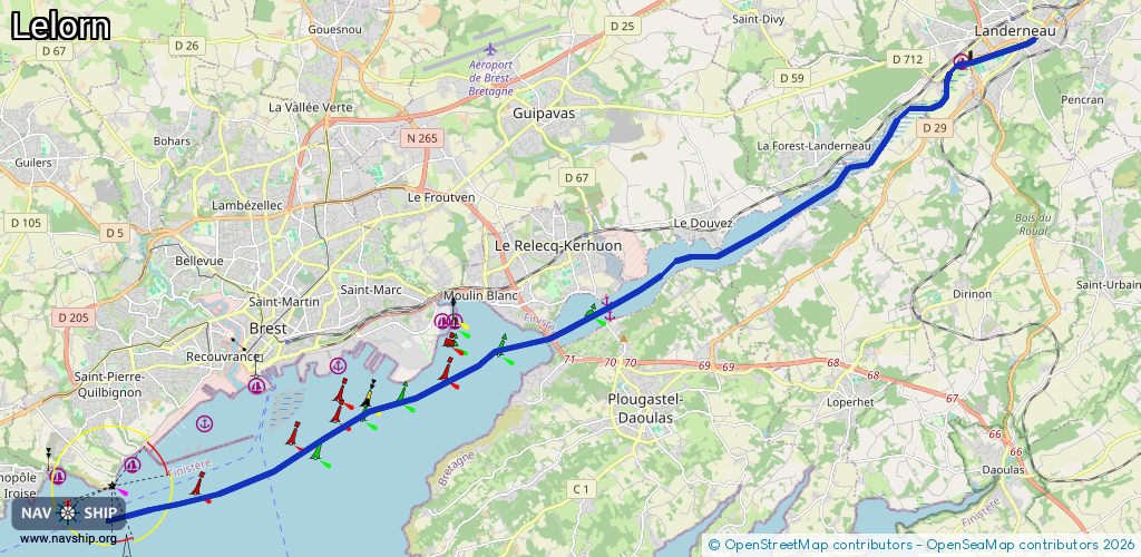
Route:
Please wait, loading route graphic...
Request waterway overview map with symbol legend here (Link).
Information about data associated with this body of water (5 available):
Data by OpenSeaMap (c) OSM contributors, www.openseamap.org
| # | Kind | Coordinates | Name | Information |
|---|---|---|---|---|
| 1 | Marina | 48.44495,-4.27236 | 2022-08-10T17:14:29Z | Cale de Plaisance de Landerneau https://www.landerneau.bzh/port-de-plaisance/ |
| 2 | Marina | 48.3961,-4.3816 | 2024-06-03T00:04:56Z | Le Passage |
| 3 | Marina | 48.39309,-4.38064 | 2015-01-28T12:02:23Z | Le Passage |
| 4 | Berth | 48.3961,-4.3816 | 2024-06-03T00:04:56Z | Le Passage marina |
| 5 | Berth | 48.39309,-4.38064 | 2015-01-28T12:02:23Z | Le Passage marina |