Waterway information

Kind:
Inland
Driving areas:
🌊 Baltic Sea🇱🇻 Latvia
Length:
4.5 km¹
¹River kilometers or bank length recorded in NavShip, including river arms and harbor entrances.
Availability:
Completely recorded
Recent Update: 09.09.2025²
² This date indicates when an adjustment last took place in the course of the body of water
Recorded:
Locks: 0
Harbours / marinas: 4
Bridges: 0
Berths: 0
Slipways: 1
Fuelstations: 0
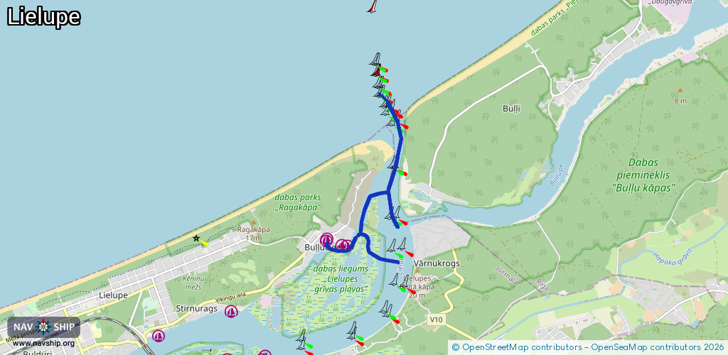
Route:
Please wait, loading route graphic...
Request waterway overview map with symbol legend here (Link).
Information about data associated with this body of water (5 available):
Data by OpenSeaMap (c) OSM contributors, www.openseamap.org
| # | Kind | Coordinates | Name | Information |
|---|---|---|---|---|
| 1 | Marina | 56.99387,23.91839 | 2022-07-12T17:37:28Z | Jahtklubs Uzvara +371 20 651 051 http://jahtklubsuzvara.lv/ |
| 2 | Marina | 56.99372,23.91814 | 2025-09-22T11:43:14Z | Jahtklubs Uzvara |
| 3 | Marina | 56.99313,23.92263 | 2025-09-22T11:43:14Z | Jūrmalas jahtklubs |
| 4 | Marina | 56.99292,23.92333 | 2021-08-13T22:45:07Z | Skautu Jahtklubs |
| 5 | Slipway | 56.99294,23.92317 | Unknown | 2022-01-26T06:17:37Z |