Waterway information

Kind:
Inland
Driving areas:
🇸🇰 Slovakia
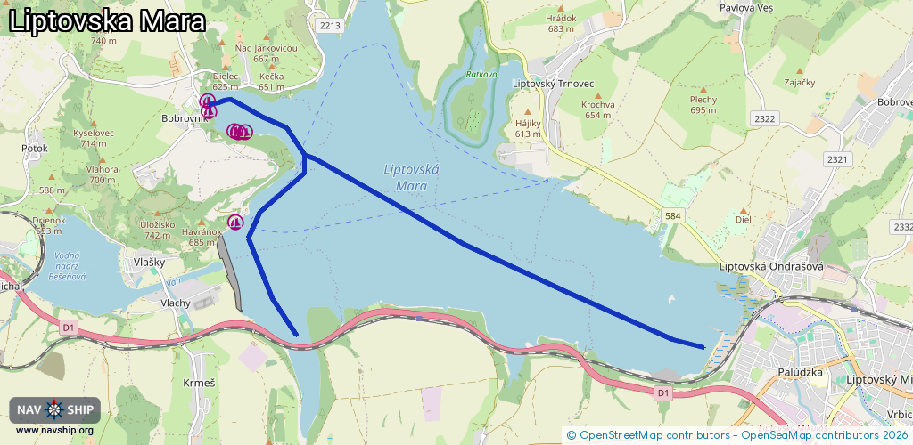
Length:
10.9 km¹
¹River kilometers or bank length recorded in NavShip, including river arms and harbor entrances.
Availability:
Completely recorded
Recent Update: 06.01.2024²
² This date indicates when an adjustment last took place in the course of the body of water
Recorded:
Locks: 0
Harbours / marinas: 6
Bridges: 0
Berths: 0
Slipways: 0
Fuelstations: 0
Route:
Please wait, loading route graphic...
Request waterway overview map with symbol legend here (Link).
Information about data associated with this body of water (6 available):
Data by OpenSeaMap (c) OSM contributors, www.openseamap.org
| # | Kind | Coordinates | Name | Information |
|---|---|---|---|---|
| 1 | Marina | 49.11722,19.48085 | 2024-07-24T10:33:25Z | |
| 2 | Marina | 49.11853,19.48072 | 2024-07-24T11:30:59Z | Marina |
| 3 | Marina | 49.11468,19.48582 | 2024-07-24T11:30:59Z | |
| 4 | Marina | 49.11455,19.48783 | 2024-07-24T11:30:59Z | |
| 5 | Marina | 49.11453,19.48654 | 2024-07-24T11:30:59Z | |
| 6 | Marina | 49.10317,19.48598 | 2023-08-29T09:20:42Z |