Waterway information

Kind:
Inland
Driving areas:
🇮🇹 Italy🌊 Sea Mediterranean
Length:
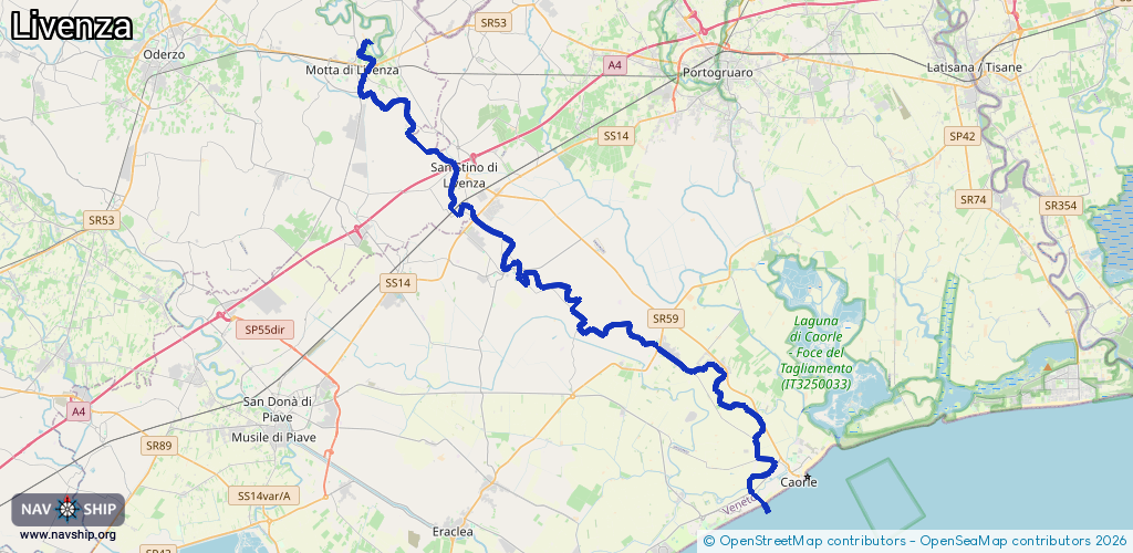
47.4 km¹
¹River kilometers or bank length recorded in NavShip, including river arms and harbor entrances.
Availability:
Completely recorded
Recent Update: 10.06.2025²
² This date indicates when an adjustment last took place in the course of the body of water
Recorded:
Locks: 0
Harbours / marinas: 4
Bridges: 0
Berths: 0
Slipways: 0
Fuelstations: 1
Route:
Please wait, loading route graphic...
Request waterway overview map with symbol legend here (Link).
Information about data associated with this body of water (5 available):
Data by OpenSeaMap (c) OSM contributors, www.openseamap.org
| # | Kind | Coordinates | Name | Information |
|---|---|---|---|---|
| 1 | Marina | 45.77623,12.61347 | 2013-11-24T07:33:17Z | Porto Turistico |
| 2 | Marina | 45.59087,12.85455 | 2024-10-08T09:19:11Z | Marina 4, Porto S. Margherita |
| 3 | Marina | 45.59043,12.85745 | 2025-03-20T10:20:18Z | |
| 4 | Marina | 45.59052,12.86196 | 2016-04-29T06:11:37Z | Porto Santa Margherita |
| 5 | Fuel station | 45.5932,12.85895 | 2025-08-28T20:54:52Z | PmC |