Waterway information

Kind:
Inland
Driving areas:
🌊 Atlantic Ocean🇫🇷 France
Length:
524.8 km¹, 1006 km official total length
¹River kilometers or bank length recorded in NavShip, including river arms and harbor entrances.
Availability:
Completely recorded
Recent Update: 16.09.2025²
² This date indicates when an adjustment last took place in the course of the body of water
Recorded:
Locks: 2
Harbours / marinas: 14
Bridges: 2
Berths: 3
Slipways: 2
Fuelstations: 0
Useful information:
The Loire is the longest river in France, flowing from central France to the Atlantic.
Navigation on the Loire has a long history and was once of great importance for the transportation of goods. Today, it is navigable for large ships only from the mouth to Nantes. Above Nantes to the confluence of the Maine at Bouchemaine, it is still used for excursion ships. These offer boat tours through picturesque landscapes and historic cities.
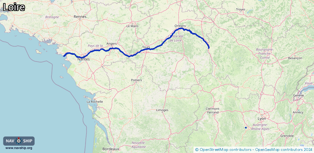
Route:
Please wait, loading route graphic...
Request waterway overview map with symbol legend here (Link).
Information about data associated with this body of water (21 available):
Data by OpenSeaMap (c) OSM contributors, www.openseamap.org
| # | Kind | Coordinates | Name | Information |
|---|
| 1 | Marina | 45.37939,4.21739 | 2024-10-08T18:26:36Z | |
| 2 | Marina | 47.27077,-2.20291 | 2021-12-11T18:17:06Z | Capitainerie |
| 3 | Marina | 45.4494,4.2561 | 2021-07-01T20:32:52Z | |
| 4 | Marina | 47.34402,-1.28986 | 2020-08-17T13:53:14Z | |
| 5 | Marina | 47.28269,-1.38421 | 2024-03-20T18:17:22Z | Port de la Pierre Percée |
| 6 | Marina | 47.19535,-1.57928 | 2023-02-06T12:35:35Z | Port de Trentemoult |
| 7 | Marina | 47.19303,-1.64647 | 2020-10-01T17:38:39Z | |
| 8 | Marina | 47.19628,-1.66988 | 2020-10-02T15:24:40Z | |
| 9 | Marina | 47.1965,-1.67051 | 2020-10-02T15:24:40Z | |
| 10 | Marina | 47.20921,-1.73063 | 2018-08-06T13:20:36Z | Port de Couëron |
| 11 | Marina | 47.28229,-1.88536 | 2023-10-03T19:26:08Z | Port de la Côte |
| 12 | Marina | 47.58627,1.34281 | 2023-06-05T18:20:01Z | |
| 13 | Marina | 47.26069,-0.07466 | 2025-08-21T11:12:30Z | Croisières Saumur Loire |
| 14 | Marina | 47.26059,-0.07448 | 2025-07-08T17:38:40Z | Restaurant Bar Sur les Quais |
| 15 | Bridge | 47.27264,-2.20166 | Unknown | Clearance height: 2025-06-28T15:36:15Z m
Maximum passage width: 4.9 m
Movable bridge (e.g. lifting bridge or drawbridge) |
| 16 | Bridge | 47.27097,-2.2021 | Unknown | Clearance height: 2026-02-03T09:42:31Z m
Movable bridge (e.g. lifting bridge or drawbridge) |
| 17 | Slipway | 47.19495,-1.5787 | Unknown | 2009-08-21T17:05:04Z |
| 18 | Slipway | 47.58633,1.34313 | Unknown | 2014-08-03T20:34:59Z |
| 19 | Berth | 47.29044,-2.02986 | 2023-01-08T09:06:01Z | |
| 20 | Berth | 47.29048,-2.03014 | 2023-01-08T09:06:01Z | |
| 21 | Berth | 47.2617,-2.22091 | 2018-08-25T17:02:42Z | |
| 21 | Berth | 47.2617,-2.22091 | 2018-08-25T17:02:42Z | |
| 21 | Berth | 47.2617,-2.22091 | 2018-08-25T17:02:42Z | |