Waterway information

Kind:
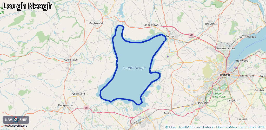
Lake
Driving areas:
🌊 Atlantic Ocean🇬🇧 United Kingdom
Length:
94.8 km¹
¹River kilometers or bank length recorded in NavShip, including river arms and harbor entrances.
Availability:
Completely recorded
Recent Update: 10.04.2025²
² This date indicates when an adjustment last took place in the course of the body of water
Recorded:
Locks: 0
Harbours / marinas: 6
Bridges: 0
Berths: 0
Slipways: 1
Fuelstations: 0
Route:
Please wait, loading route graphic...
Request waterway overview map with symbol legend here (Link).
Information about data associated with this body of water (7 available):
Data by OpenSeaMap (c) OSM contributors, www.openseamap.org
| # | Kind | Coordinates | Name | Information |
|---|---|---|---|---|
| 1 | Marina | 54.63237,-6.50537 | 2025-06-07T09:35:41Z | |
| 2 | Marina | 54.65316,-6.296 | 2023-11-26T20:32:16Z | |
| 3 | Marina | 54.7503,-6.47251 | 2022-05-21T19:13:10Z | |
| 4 | Marina | 54.75105,-6.48346 | 2022-05-21T19:13:10Z | |
| 5 | Marina | 54.74763,-6.50145 | 2022-05-21T19:13:10Z | |
| 6 | Marina | 54.72547,-6.51475 | 2022-05-21T19:13:10Z | |
| 7 | Slipway | 54.63274,-6.5055 | Unknown | 2020-04-27T21:24:57Z |