Waterway information

Kind:
Inland
Driving areas:
🌊 Pacific Ocean🇹🇼 Taiwan
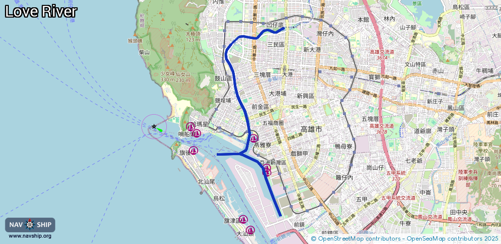
Length:
10.2 km¹
¹River kilometers or bank length recorded in NavShip, including river arms and harbor entrances.
Availability:
Completely recorded
Recent Update: 29.01.2025²
² This date indicates when an adjustment last took place in the course of the body of water
Recorded:
Locks: 0
Harbours / marinas: 3
Bridges: 0
Berths: 0
Slipways: 0
Fuelstations: 0
Route:
Please wait, loading route graphic...
Request waterway overview map with symbol legend here (Link).
Information about data associated with this body of water (3 available):
Data by OpenSeaMap (c) OSM contributors, www.openseamap.org
| # | Kind | Coordinates | Name | Information |
|---|---|---|---|---|
| 1 | Marina | 22.61746,120.29194 | 2023-02-04T06:21:39Z | 愛河灣遊艇碼頭A區 |
| 2 | Marina | 22.60601,120.29654 | 2023-06-18T14:37:59Z | 嘉信22號遊艇碼頭 |
| 3 | Marina | 22.60744,120.29632 | 2023-01-30T05:14:29Z | 亞灣遊艇碼頭 |