Waterway information

Kind:
Sea
Driving areas:
🇩🇪 Germany🌊 North Sea
Length:
4.6 km¹
¹River kilometers or bank length recorded in NavShip, including river arms and harbor entrances.
Availability:
Completely recorded
Recent Update: 29.06.2023²
² This date indicates when an adjustment last took place in the course of the body of water
Recorded:
Locks: 0
Harbours / marinas: 2
Bridges: 1
Berths: 0
Slipways: 1
Fuelstations: 0
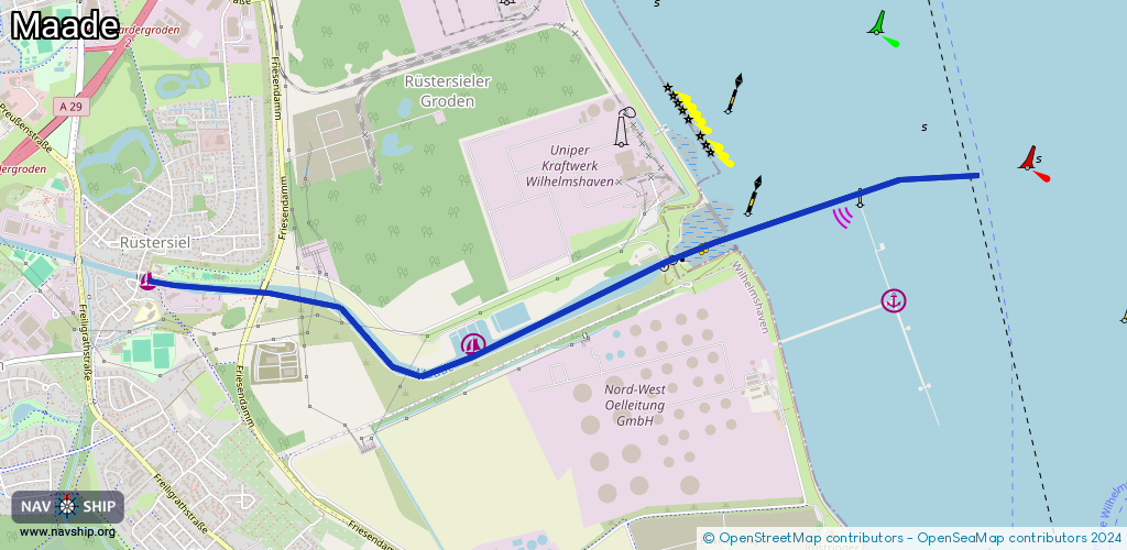
Route:
Please wait, loading route graphic...
Request waterway overview map with symbol legend here (Link).
Information about data associated with this body of water (4 available):
Data by OpenSeaMap (c) OSM contributors, www.openseamap.org
| # | Kind | Coordinates | Name | Information |
|---|---|---|---|---|
| 1 | Marina | 53.55961,8.10931 | 2025-08-22T10:23:04Z | Alter Rüstersieler Hafen [email protected] +49 170 9687693 https://www.ruestersiel-hafen.de/ |
| 2 | Marina | 53.55654,8.13472 | 2024-07-13T13:06:45Z | Segelkameradschaft Geniusbank (SKG) http://www.skg-whv.de/ [email protected] +49 4421 34948 http://www.skg-whv.de/ [email protected] +49 |
| 3 | Bridge | 53.56025,8.14967 | Unknown | Clearance height: 2017-06-21T23:11:50Z m bascule |
| 4 | Slipway | 53.55919,8.11108 | small_craft_facility | 2013-01-16T14:59:07Z |