Waterway information

Kind:
Inland
Driving areas:
🇬🇧 United Kingdom
Length:
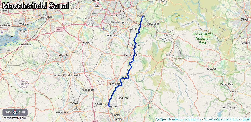
44.2 km¹
¹River kilometers or bank length recorded in NavShip, including river arms and harbor entrances.
Availability:
Completely recorded
Recent Update: 08.01.2024²
² This date indicates when an adjustment last took place in the course of the body of water
Recorded:
Locks: 15
Harbours / marinas: 6
Bridges: 0
Berths: 0
Slipways: 0
Fuelstations: 0
Route:
Please wait, loading route graphic...
Request waterway overview map with symbol legend here (Link).
Information about data associated with this body of water (8 available):
Data by OpenSeaMap (c) OSM contributors, www.openseamap.org
| # | Kind | Coordinates | Name | Information |
|---|---|---|---|---|
| 1 | Marina | 53.09102,-2.25581 | 2023-05-14T09:27:04Z | |
| 2 | Marina | 53.11632,-2.23961 | 2025-01-11T23:51:27Z | Heritage Marina https://heritagenarrowboats.co.uk/ |
| 3 | Marina | 53.21268,-2.13573 | 2022-10-13T07:24:19Z | |
| 4 | Marina | 53.2568,-2.11487 | 2021-10-03T18:59:55Z | |
| 5 | Marina | 53.33237,-2.0922 | 2024-06-08T17:24:08Z | Lyme View Marina |
| 6 | Marina | 53.36407,-2.07779 | 2024-03-29T10:29:27Z | North Cheshire Cruising Club |
| 7 | Lock | 53.08866,-2.24804 | Unknown | |
| 7 | Lock | 53.08866,-2.24804 | Unknown | |
| 7 | Lock | 53.08866,-2.24804 | Unknown | |
| 7 | Lock | 53.08866,-2.24804 | Unknown | |
| 7 | Lock | 53.08866,-2.24804 | Unknown | |
| 7 | Lock | 53.08866,-2.24804 | Unknown | |
| 7 | Lock | 53.08866,-2.24804 | Unknown | |
| 7 | Lock | 53.08866,-2.24804 | Unknown | |
| 7 | Lock | 53.08866,-2.24804 | Unknown | |
| 7 | Lock | 53.08866,-2.24804 | Unknown | |
| 7 | Lock | 53.08866,-2.24804 | Unknown | |
| 7 | Lock | 53.08866,-2.24804 | Unknown | |
| 8 | Lock | 53.19666,-2.14493 | Bosley Locks | |
| 8 | Lock | 53.19666,-2.14493 | Bosley Locks | |
| 8 | Lock | 53.19666,-2.14493 | Bosley Locks |