Waterway information

Kind:
Inland
Driving areas:
🇮🇹 Italy🌊 Sea Mediterranean
Length:
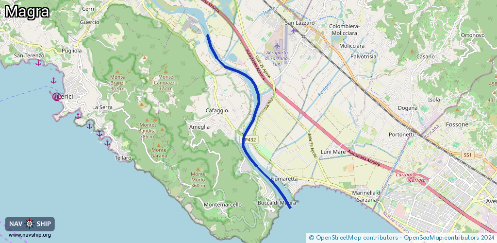
6.1 km¹
¹River kilometers or bank length recorded in NavShip, including river arms and harbor entrances.
Availability:
Completely recorded
Recent Update: 12.09.2023²
² This date indicates when an adjustment last took place in the course of the body of water
Recorded:
Locks: 0
Harbours / marinas: 4
Bridges: 0
Berths: 0
Slipways: 0
Fuelstations: 0
Route:
Please wait, loading route graphic...
Request waterway overview map with symbol legend here (Link).
Information about data associated with this body of water (4 available):
Data by OpenSeaMap (c) OSM contributors, www.openseamap.org
| # | Kind | Coordinates | Name | Information |
|---|---|---|---|---|
| 1 | Marina | 44.08024,9.9735 | 2025-08-13T17:47:39Z | Luni Yachting customers |
| 2 | Marina | 44.07487,9.98148 | 2025-03-09T16:19:36Z | Marina 3B https://www.marina3b.it/ |
| 3 | Marina | 44.06148,9.97443 | 2025-08-22T14:59:17Z | Bocca di Magra Marina del Ponte |
| 4 | Marina | 44.04608,9.98579 | 2025-08-13T18:18:17Z | Porto Bocca di Magra http://www.portoboccadimagra.it |